 PlaceTube
Surtsey
Vestmannaeyjar, Iceland · Videos: 14 · Map
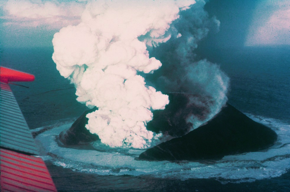
Volcanic island off the coast of Iceland
Surtsey ("Surtr's island" in Icelandic) is an uninhabited volcanic island located in the Vestmannaeyjar archipelago off the southern coast of Iceland. At Surtsey is the southernmost point of Iceland. It was formed in a volcanic eruption which began 130 metres below sea level, and reached the surface on 14 November 1963. The eruption lasted until 5 June 1967, when the island reached its maximum size of 2.7 square kilometres. Since then, wave erosion has caused the island to steadily diminish in size: As of 2012, its surface area was 1.3 square kilometres. The most recent survey (2007) shows…
What travel creators say
The presenter describes Surtsey, an island born from a volcanic eruption between 1963 and 1967 off Iceland's south coast, now closed to almost everyone except a few permitted scientists.
The southernmost point of Iceland, an island born from an underwater eruption between 1963 and 1967, serving as a natural laboratory for studying geological and biological processes.
A volcanic island off the south coast formed by eruptions between 1963 and 1967, one of the best-known examples of new land formation on Earth.
The presenter mentions that the famous Surtsey eruption occurred just nearby in 1963 and that the island is still standing.
He describes Surtsey as one of the youngest pieces of land on the planet, formed in 1963 by an underwater volcano.
A new island created a few kilometres from Heimaey in 1963 when Surtsey rose from the seabed; it is a closed science project today and a reminder of the forces in the area.
A new island that emerged from the sea in 1963 and erupted for four years, now a strictly protected UNESCO World Heritage Site and pristine natural laboratory.
From videos in other languages
1963'te İzlanda'nın güney kıyısı açıklarında volkanik patlamalarla doğan yeni ada; videonun tamamı adanın oluşumunu, bitki ve kuşlarla nasıl yaşam kazandığını ve dalgalarla nasıl aşındığını anlatıyor.
Ilha vulcânica ao largo da costa sul da Islândia, formada por erupções entre 1963 e 1967, um dos exemplos mais conhecidos de formação de novas terras na Terra moderna.
Una de las islas más jóvenes del planeta, formada entre 1963 y 1967 por erupciones submarinas, laboratorio natural de colonización biológica.
Isla surgida de una erupción submarina entre 1963 y 1967, el punto más al sur de Islandia y un laboratorio natural para los científicos.
Остров, возникший в 1963 году в результате подводного извержения и считающийся одним из самых молодых в мире; доступ закрыт, так как учёные изучают формирование экосистемы.
Una de las islas más jóvenes de la Tierra, formada por una erupción volcánica frente a la costa sur el 14 de octubre de 1963 y declarada Patrimonio de la Humanidad por la UNESCO.
En noviembre de 1963 una erupción submarina hizo nacer esta isla, hoy reserva natural y Patrimonio de la Humanidad a la que casi nadie puede acceder; el mar ya le ha arrebatado más de la mitad de su superficie.