 PlaceTube
Oregon | Is This the Most ALIEN Landscape in America? | Travel Documentary 4K
Open in PlaceTube Watch on YouTube
Places in this video
- Columbia River Gorge ▶ 1:59
The video introduces the Columbia River Gorge as an 80-mile canyon cut through the Cascade Range, with cliffs, forests and waterfalls unlike anywhere else on the continent.
- Multnomah Falls ▶ 2:33
Described as Oregon's tallest waterfall, dropping 620 feet in two tiers, with a footbridge spanning the canyon and nearly two million visitors a year.
- Vista House ▶ 3:23
A 1918 stone observatory at Crown Point, perched 733 feet above the river, offering sweeping views east and west through the gorge.
- Historic Columbia River Highway ▶ 3:41
The scenic highway winds past Vista House and connects Latourell Falls and Elowah Falls along its route.
- Columbia River Gorge National Scenic Area ▶ 3:59
The protected area preserves the whole gorge landscape and the communities of Bonneville and The Dalles along its banks.
- Wahclella Falls ▶ 4:19
A two-tiered cascade at the end of a short forest trail, hidden in a moss-covered amphitheater and dropping into an emerald pool.
- Mount Hood National Forest ▶ 5:11
Over a million acres of volcanic terrain, conifer slopes and bare rock, home to Oregon's tallest peak.
- Mount Hood ▶ 5:53
The 11,249-foot summit is permanently capped in snow and ice, with 11 glaciers and a last major eruption in the 1820s.
- Timberline Lodge ▶ 6:42
Built by WPA workers during the Depression at 6,000 feet, with handcrafted furniture and ironwork; its exterior appeared in The Shining.
- Trillium Lake ▶ 7:32
A small lake below the timberline whose still surface gives a near-perfect reflection of Mount Hood on calm mornings.
- Silver Falls State Park ▶ 8:36
9,000 acres of old-growth forest holding more waterfalls than any other Oregon park, with a trail that passes behind ten of them.
- South Falls ▶ 9:10
Water plunges 177 feet over a basalt cliff, and the trail curves behind the curtain of falling water itself.
- North Falls ▶ 9:59
A 136-foot drop into a grotto carved by erosion, where the trail passes behind the falls through a cavern lined with basalt columns.
- Sahalie Falls ▶ 10:51
The McKenzie River plunges over 100 feet here against basalt walls blackened by ancient lava flows, shaking the forest floor.
- Koosah Falls ▶ 11:38
A second cascade dropping 70 feet into a pool so blue it seems lit from within, colored by snowmelt filtered through volcanic rock.
- McKenzie River National Recreation Area ▶ 12:58
Protects much of the river corridor, preserving the volcanic landscape and ancient forests of the region.
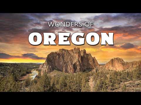
- Smith Rock State Park ▶ 13:17
Towering walls of welded tuff rise 300 feet above the Crooked River, drawing climbers from around the world.
- Newberry National Volcanic Monument ▶ 14:37
A massive shield volcano whose caldera stretches across 500 square miles, with two lakes and obsidian lava flows.
- Phil's Trail ▶ 15:38
A trail network winding through ponderosa pine forests scarred by ancient eruptions, popular with hikers and mountain bikers.
- Sparks Lake ▶ 16:37
A shallow alpine lake above 5,000 feet surrounded by jagged black lava flows, known for mirror-like reflections.
- Mount Bachelor ▶ 17:16
A symmetrical stratovolcano that last erupted about 15,000 years ago, standing alone and snow-covered much of the year.
- Lava Lake ▶ 18:03
A clear, cold lake formed when molten rock dammed an ancient stream, ringed by lodgepole pines with the Three Sisters on the skyline.
- Cascade Lakes Scenic Byway ▶ 18:41
A route threading through old-growth forest and meadows, connecting the alpine lakes and volcanic remnants of the High Cascades.
- Bend ▶ 19:32
A high-desert city where volcanic soil meets rushing water, an unexpected oasis between mountain and desert.
- Deschutes River ▶ 19:55
Born from snowmelt and springs, the cold, clear river runs through Central Oregon, shared by kayakers and fly fishermen.
- Mirror Pond ▶ 20:31
A stretch of the Deschutes in Bend where the water slows and reflects the sky like polished glass.
- Painted Hills ▶ 21:37
Bands of red, gold and black stripe across rounded slopes of volcanic ash, a landscape that feels borrowed from another planet.
- Hells Canyon ▶ 23:57
Nearly 8,000 feet from rim to river, the deepest gorge in North America, carved by the Snake River through layered basalt.
- Crater Lake National Park ▶ 26:12
Holds the deepest lake in the United States, filled only by rain and snow, its water an impossibly intense blue.
- Wizard Island ▶ 27:45
A small volcano within a volcano rising from the lake, with cinder slopes climbing to a crater at its peak.
- Crater Lake Lodge ▶ 28:32
A historic lodge on the southern rim, welcoming travelers since 1915 with views over the caldera from its Great Hall and veranda.
- Rogue River ▶ 29:20
The wild river carves through southwestern Oregon, named by French trappers for its treacherous rapids and unpredictable currents.
- Takelma Gorge ▶ 30:03
The Rogue squeezes through narrow volcanic walls here in churning cascades, named for the Takelma people who lived along its banks.
- Lost Creek Lake ▶ 30:55
A dammed section of the Rogue offering calmer waters surrounded by evergreen hills.
- Mill Creek Falls ▶ 31:07
A 173-foot waterfall plunging into a misty basin, one of the tallest in southern Oregon.
- Ashland ▶ 31:49
A small city at the base of the Siskiyou Mountains, known for its cultural life and historic downtown.
- Siskiyou Mountains ▶ 32:13
One of the most botanically diverse ranges in North America, with serpentine soils producing species found nowhere else on Earth.
- Harris Beach State Park ▶ 34:21
Sea stacks rise from the surf like monuments, with Bird Island hosting nesting seabirds and tide pools dotting the rocky shore.
- Chetco River ▶ 35:18
Water so clear you can count stones on the riverbed, flowing from the Kalmiopsis Wilderness to the Pacific at Brookings.
- Bandon ▶ 36:30
A small town backed by forest and fronted by a beach lined with sea stacks sculpted by the ocean.
- Bandon Beach ▶ 37:03
A beach beneath towering rock formations that shifts with every tide, with tide pools at the base of the stacks.
- Face Rock ▶ 37:18
A sea stack offshore whose profile is frozen in basalt and has been the subject of local legend for generations.
- Bandon Dunes Golf Resort ▶ 37:50
Links-style courses following coastal dunes, feeling more Scottish Highlands than Pacific Northwest, drawing players since 1999.
- Coquille River Lighthouse ▶ 38:50
Built in 1896 at the mouth of the Coquille River, it now serves as a museum with views across the jetty and out to sea.
- Oregon Dunes ▶ 39:48
The largest expanse of coastal dunes in North America, a 40-mile sea of sand with ridges over 500 feet high that inspired Dune's Arrakis.
- Heceta Head ▶ 42:04
A headland rising 200 feet above the Pacific, crowned by a lighthouse guiding mariners since 1894, with a keeper's house now a bed and breakfast.
- Sea Lion Caves ▶ 43:30
One of the largest sea grottos in the world, a natural cathedral where Steller sea lions haul out, reached by an elevator dropping 200 feet through rock.
- Yachats ▶ 45:42
A small village at the base of Cape Perpetua, where the earth rises 800 feet above the churning sea.
- Cape Perpetua ▶ 46:14
A headland blanketed in ancient Sitka spruce, named by Captain Cook in 1778, with views stretching 40 miles from its summit shelter.
- Devil's Churn ▶ 47:05
A narrow inlet where waves funnel in with tremendous force, exploding upward in towers of white spray.
- Thor's Well ▶ 47:37
A circular hole in the coastal shelf that appears to drain the ocean, erupting skyward at mid tide.
- Spouting Horn ▶ 48:26
A coastal feature that adds its voice to the symphony of pressurized seawater and ancient stone near Cape Perpetua.
- Newport ▶ 48:45
A working waterfront community on the Central Coast where the rhythm of the sea dictates daily life.
- Yaquina Head Lighthouse ▶ 49:16
The tallest lighthouse on the Oregon coast, rising 93 feet above basalt cliffs and guiding mariners since 1873.
- Yaquina Bay Bridge ▶ 50:25
A 1936 Art Deco bridge spanning over 3,000 feet, one of the most photographed on the Pacific Coast.
- Historic Bayfront ▶ 50:57
The bayfront stretches beneath the bridge, where fishing boats still unload their daily catch.
- Cape Kiwanda ▶ 51:21
A massive sandstone headland with golden cliffs shaped by wind and wave, where surfers gather below and hikers climb the backing dune.
- Chief Kiwanda Rock ▶ 52:23
A sea stack once connected to the mainland, now enduring constant wave assault, with seabirds nesting on its peak.
- Devil's Punch Bowl ▶ 53:16
A collapsed sea cave near Otter Rock where high tides send water churning into a natural cauldron open to the sky.
- Tillamook ▶ 54:08
A northern coast town where the shore softens into wide estuaries and dairy pastures rolling toward the sea.
- Tillamook Bay ▶ 54:38
Five rivers empty into this estuary, with oyster beds in the shallows and fishing boats passing shifting sandbars.
- Tillamook Rock Lighthouse ▶ 55:36
A lighthouse atop an isolated basalt rock a mile offshore, nicknamed Terrible Tilly, abandoned since 1957.
- Cannon Beach ▶ 56:43
A quiet coastal town with sandy expanses framed by forested headlands, where many first encounters with Oregon's wild coast begin.
- Haystack Rock ▶ 57:13
A 235-foot basalt sea stack formed 15 million years ago, with tide pools of urchins and starfish and nesting tufted puffins.
- Portland ▶ 58:59
Oregon's urban heart, rising on both banks of the Willamette, where bridges stitch together very different neighborhoods.
- Burnside Bridge ▶ 59:21
A 1926 bascule drawbridge carrying traffic between the east and west sides, its center span lifting for ships below.
- Tilikum Crossing ▶ 1:00:00
A 2015 cable-stayed bridge banning private cars, with LED lights that shift color based on water temperature, river speed and moon phases.
- Willamette River ▶ 1:00:44
Runs more than 180 miles from the Cascades to the Columbia, with decades of restoration bringing salmon back to its waters.
- Tom McCall Waterfront Park ▶ 1:00:59
A green corridor along the western bank where the city opens itself to the river, framing a skyline built between mountains and water.
Cities in these videos
Cascade Locks · Corbett · Government Camp · Sublimity · McKenzie Bridge · Terrebonne · Bend · Mitchell · Joseph · Crater Lake · Prospect · Ashland · Brookings · Bandon · North Bend · Florence · Yachats · Newport · Pacific City · Otter Rock · Tillamook · Cannon Beach · Portland