 PlaceTube
Yoshino River
Gojo, Japan · Videos: 11 · Map
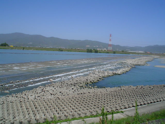
River in Shikoku, Japan
The Yoshino River (吉野川 Yoshino-gawa) is a Class A river on the island of Shikoku, Japan. It is 194 kilometres long and has a watershed of 3,750 square kilometres. It is the second longest river in Shikoku (slightly shorter than the Shimanto), and is the only river whose watershed spreads across all four prefectures of the island.
What travel creators say
Known as Shikoku Saburo, one of Japan's three great rivers, with nostalgic submersible bridges offering a glimpse of the timeless countryside.
Its fertile floodplain made the basin Japan's main indigo-producing area over 800 years ago.
The presenter admires the beautiful Yoshino River, formed by an approximately 8-km torrent, visible from the restaurant near the rental car facility.
From videos in other languages
徳島駅近くから吉野川に到着し、川沿いを上流方向へ歩いていく。全長194kmの大きな川で、橋の多さでも有名。
街並みの両側の水路はこの川から引いたもので、洗い場や防火用水、雪流しに使われたと説明する。
進行方向右手に広がる大きな川。徳島線は「吉野川ブルーライン」とも呼ばれ、日本三大暴れ川の一つとして紹介される。
穴吹駅のすぐ南を流れる川で、駅や国道192号線が川に近い位置にあると説明。橋の上から見下ろす自然の景色が圧巻だと話しています。
日本三大暴れ川の一つ。遊覧船から川底が見えるほど美しく、国の天然記念物の景観も楽しめます。
四国三郎と呼ばれる大きな川。徳島線はこの川に沿って走り、昔は木材を流して運んでいた。
かつて吉野杉を筏に組んで筏師が下った川。五條繁栄のルーツであり、橋本に入ると紀の川に変わる。
列車が吉野川沿いを走り、鉄橋を渡る様子を眺めながら高知へ向かいます。