 PlaceTube
Lava Butte
Bend, United States · Videos: 6 · Map
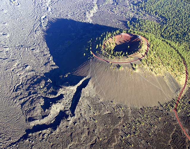
Cinder cone in central Oregon, United States
Lava Butte is a cinder cone in central Oregon, United States, just west of U.S. Route 97 between the towns of Bend, and Sunriver in Deschutes County. It is part of a system of small cinder cones on the northwest flank of Newberry Volcano, a massive shield volcano which rises to the southeast. The cinder cone is capped by a crater which extends about 60 feet deep beneath its south rim, and 160 feet deep from the 5,020 feet summit on its north side. Lava Butte is part of the Newberry National Volcanic Monument.
What travel creators say
A cinder cone they hike up, with a tiny parking lot, informational signs and a visitor center with a trail around it.
The presenter hikes the short trail through the lava field to a lookout point, noting the ranger said walking is more interesting than the shuttle, and that it's open 24/7 for night visits.
Drive to the top of this cinder cone for amazing views of lava flows, the Sisters, Broken Top and Mount Bachelor, plus an active fire lookout.
The cinder cone that produced the surrounding lava flows, last erupting 7,000 years ago; they hike up since the road is closed in winter.
From videos in other languages
Sisten hiçbir şey görünmese de 1.531 metre yükseklikteki bu lav tepesine çıktıklarını ve manzaranın güzel olduğunu söylüyorlar.
Menciona el centro de visitantes con un camión que te lleva a la cima del cono volcánico, con mirador y vistas del paisaje.