 PlaceTube
Cape Sata
Kimotsuki, Japan · Videos: 12 · Map
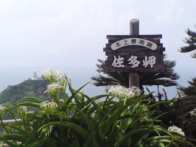
Cape in Kyūshū island, Japan
Cape Sata (佐多岬, Sata Misaki) is a cape at the southern tip of the Ōsumi Peninsula of Kyūshū island, Japan. It is the southernmost point of the island, and therefore of the overall Japanese Home Islands (Hokkaidō, Honshū, Shikoku, and Kyūshū), just south of 31 degrees latitude. It belongs to the town of Minamiōsumi, Kagoshima Prefecture. It is within the borders of the Kirishima-Kinkōwan National Park, in the town of Minamiōsumi. The area contains a Shinto shrine, the Misaki Shrine, and is also home to the Satamisaki Lighthouse built in 1871, designed by the Scotsman Richard Henry Brunton…
What travel creators say
After crossing the lava connection to the Osumi Peninsula, he drives the coastal road to mainland Japan's southernmost point, Cape Sata.
They stumble upon a beautiful beach and reach the southernmost tip of mainland Japan, walking through a tunnel to the point and a small shrine.
The southernmost point of Kyushu's main island comes into view from the ferry about 2 hours after departure.
From videos in other languages
大隅半島の最南端、日本本土最南端の岬。亜熱帯性の植物が多く生育し、約50m沖の灯台がこの地を静かに見守り続けていると語る。
本土最南端の絶景スポット。駐車場から遊歩道を歩いて展望台を目指し、2月なのに暑いくらいの晴天の中、素晴らしい景色を堪能します。
日本本土最南端の岬で、今回のドライブ旅の最終目的地。駐車場から展望台まで往復40分ほど歩くと説明します。
長い道のりを経て佐多岬に到着し、証明書をもらう。
本土最南端にある絶景スポット。駐車場から展望台まで20分ほど歩き、遮るものがない強風に注意が必要だと語っています。
根占港から南下すると行ける日本の本土最南端の岬で、その様子は別の動画で紹介していると案内します。
右手に見えた大隅半島の先端で九州本土の最南端。岬付近に北緯31度線が通ると紹介された。
九州最南端の佐多岬に到着。風が強く、海がとても綺麗で絶景が広がっていると感動しています。
日本本土最南端とされる岬。北緯31度の碑があり、亜熱帯的な植物が育つ様子を紹介している。