 PlaceTube
Byobugaura
Choshi, Japan · Videos: 10 · Map
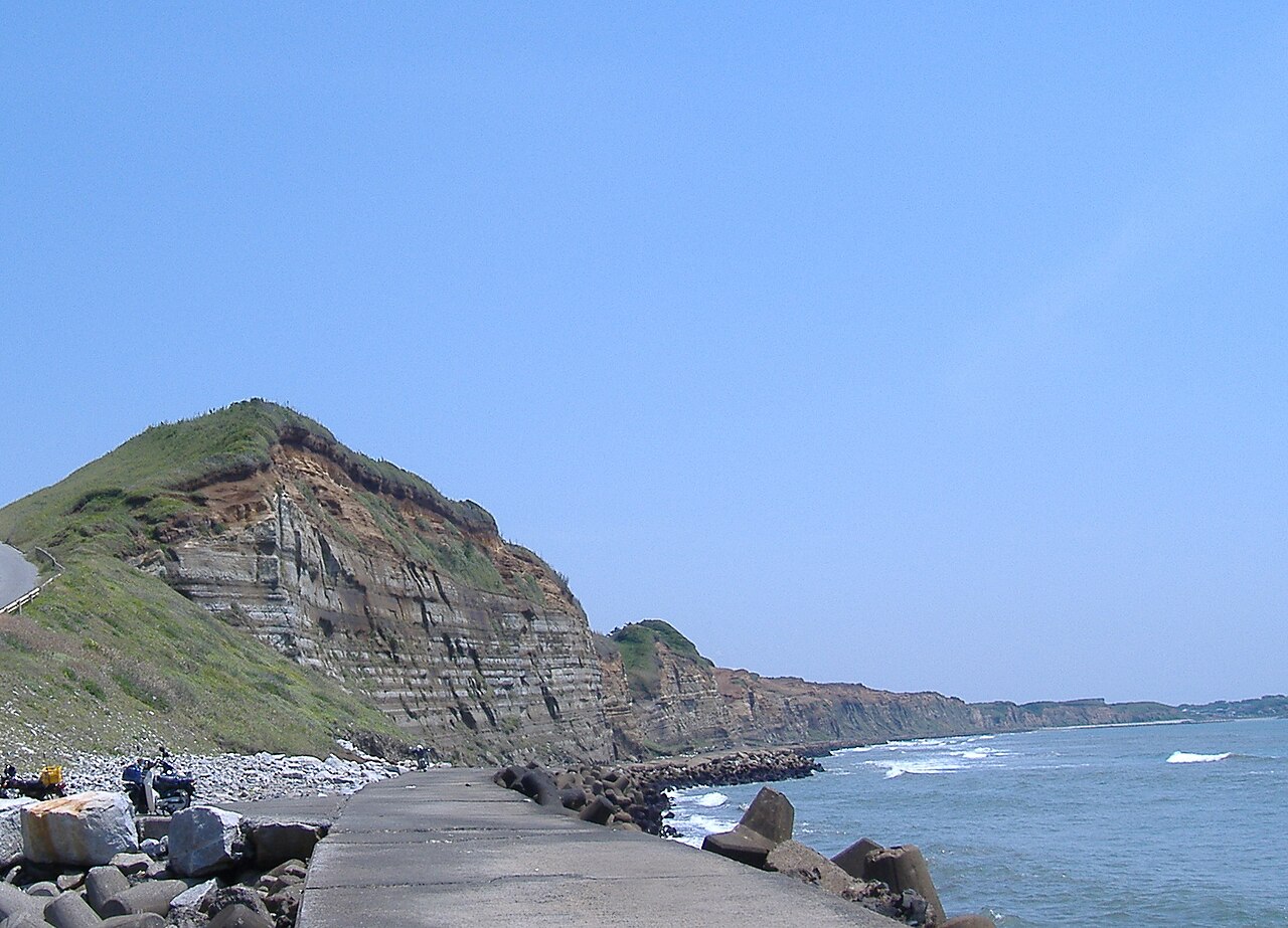
Byōbugaura is an inlet on the northeast coast of Chiba Prefecture that ranges from Cape Inubō in Chōshi to Cape Gyōbumi in Asahi. Byōbugaura is an important part of the coastal area in Chiba Prefecture, as it connects the northern point of the Pacific Ocean coast at Chōshi to Kujūkuri Beach, which covers a large portion of the western side of the prefecture. The name of the inlet is formed from the word "byōbu", the Japanese-style folding screen, and "ura", meaning an inlet. Byōbugaura resembles the White Cliffs of Dover on the English Channel. For this reason the inlet is sometimes called…
What travel creators say
Long, sheer wave-eroded cliffs known as the 'Dover of Japan,' which the presenter visits at the end of the journey.
A national scenic spot and natural monument: cliffs 20–60 meters high stretching 10 kilometers from Choshi to Asahi City, with layered fossils and land eroding 50–100 cm a year.
From videos in other languages
刑部岬の展望台から太平洋の大パノラマが広がり、崖の下から見上げる屏風ヶ浦の迫力に圧倒されます。
波の侵食で削られた崖が犬岩から約10kmにわたって続く絶景。遊歩道から波食窪や美しい模様の地層を眺め、海外みたいな景色だと感動しています。
全長約10kmの海食崖。かつては年間1mずつ侵食されていたが、今は消波ブロックで途中までしか歩けない。
江戸時代から人気の観光地で、屏風を立てたような景観。高さ40〜50mの断崖絶壁が10kmほど続き、様々な年代の地層が見られると紹介しています。
千葉県銚子市にある屏風ヶ浦を訪れ、約10キロ続く断崖絶壁の絶景を紹介。イギリスのドーバー海峡の白い壁に似ていることから「東洋のドーバー」と呼ばれていると説明しています。
旭から銚子まで約10km続く白い崖の絶景。隆起と浸食でできた地形で「東洋のドーバー」と呼ばれると説明される。
高さおよそ60メートルの切り立った断崖が10キロ近くも続く屏風浦
高さ50メートルの崖が長さ10kmも続く絶壁の海岸で、東洋のドーバーと言われるほど雄大な景観だと語っています。