 PlaceTube
Muztagh Ata
Kashgar, China · Videos: 18 · Map
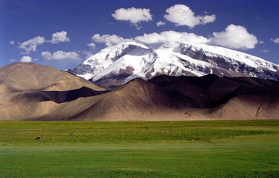
Mountain in the Pamir range, located in China
Muztagh Ata, formerly known as Mount Tagharma and Wi-tagh, is the second highest of the mountains which form the northern edge of the Tibetan Plateau, with an elevation of 7,546 m (24,757 ft). It is sometimes regarded as being part of the Kunlun Mountains, although physically it is more closely connected to the Pamirs. It is one of the relatively easier 7,000 m peaks in the world to climb, due to its gentle western slope and the comparatively drier weather of Xinjiang, though a thorough acclimatization period and a very strong physical condition are crucial for success.
What travel creators say
The peak rises more than 7,500 m above sea level, towering over the Karakoram Highway below.
Listed as an inclusion on a Pamir Plateau trip alongside Tashkurgan and Panlong Ancient Road.
The impressive 7,000 m mountain looms over Karakul Lake; the presenter notes it's said to be the easiest 7,000 m peak to climb.
At 7,546 m, the 'father of ice mountains', called the easiest 7,500-m peak on Earth with wide, gradual glacier slopes and no technical sections; you can even ski from the summit.
Driving up National Highway 314 near the Akto–Tashkurgan county line, Lily is awed as the 7,509-meter "Father of Icebergs" suddenly fills her entire view.
Mustagh Ata Peak is presented as one of the immortal legends of the Pamir Plateau.
The snow-capped peak stands like a silent clock measuring presence rather than time as the drive crosses the Pamirs.
After Baisha Lake they drive about 50 minutes to Muztagh Peak, the 7,509-meter 'Father of Glaciers' that stays in view the whole way, looking like a giant covered in ice and snow.
The presenter describes the famous Muztagh Ata behind Karakul Lake, about 7,600 meters high and towering and majestic.
The 'father of glaciers', always seeming to guide the way along the Pamir highway.
From videos in other languages
喀什到塔县沿途的著名雪山风景之一。
冰川融化形成一個小小的冰川湖,陽光反射下白色冰川很漂亮,可見冰川崩塌的飛瀑,頂峰隱藏在雲間。
ภูเขาสูง 7,546 ม. ที่เห็นจากทะเลสาบคาราคูล มีรูปทรงโดมและได้ชื่อว่าเป็นยอดเขาระดับ 7,000 ม. ที่ปีนง่ายที่สุดในโลก
현지어로 '빙산의 아버지'라는 뜻의 봉우리로, 카라쿨 호수 너머로 보인다고 소개한다.
Vincent, Pamir Platosu'ndaki bu 7.546 metrelik zirveyi gösteriyor; ancak zirve bulutlarla kaplı.
Được xem là cha của các sông băng tại Trung Quốc, quanh năm tuyết phủ.
博主介绍慕士塔格海拔7546米,是登山爱好者的圣地,坡度较缓,常被当作登珠峰的入场券。
再往东是塔吉克斯坦的库拉马口岸,过了口岸就是中国卡拉苏口岸,能看到巨大的冰山穆兹塔格峰。