 PlaceTube
The Untamed Heart: Discovering the Greatest Wilderness Areas in Europe
Open in PlaceTube Watch on YouTube
Places in this video
- Vatnajökull ▶ 3:40
The presenter describes Vatnajökull as Europe's second-largest ice cap, covering about 8% of Iceland, with active volcanoes like Grímsvötn and Bárðarbunga beneath it and jökulhlaup floods surging across the Skeiðarársandur plain.
- Crystal Ice Cave ▶ 5:43
The presenter explains that this seasonal ice cave near the Breiðamerkurjökull outlet glacier glows cobalt and sapphire as sunlight refracts through bubble-free, centuries-old ice, and that it can only be visited on guided winter tours.
- Jökulsárlón ▶ 6:53
The presenter describes this proglacial lagoon fed by the Breiðamerkurjökull glacier tongue, where icebergs calve from the ice front and drift slowly toward the ocean.
- Vatnajökull National Park ▶ 7:23
The presenter notes the park was established in 2008 and made a UNESCO World Heritage site in 2019, protecting glaciers, volcanic craters, lava fields and geothermal systems, with black sand beaches scattered with glacial ice nearby.
- Landmannalaugar ▶ 11:21
The presenter describes this rhyolite highland area in the Fjallabak Nature Reserve, with mountains stained red, orange, yellow and green by hydrothermal alteration, and geothermal pools where travellers have long bathed.
- Ljótipollur ▶ 13:13
The presenter explains that Ljótipollur, whose name means 'ugly puddle', is a nearly circular crater lake with a deep blue lake ringed by steep red volcanic walls, formed in the 1477 eruption of the Torfajökull system.
- Laugavegur Trail ▶ 15:49
The presenter says Landmannalaugar is the northern start of the roughly 55 km Laugavegur hiking trail south to Þórsmörk, crossing lava fields, snow patches, glacial rivers and moss-covered ridges.
- Látrabjarg ▶ 18:03
The presenter describes Látrabjarg as Iceland's westernmost point, with basalt cliffs up to 441 m dropping straight into the North Atlantic and millions of puffins, razorbills and guillemots nesting there from May to August.
- Svalbard ▶ 23:40
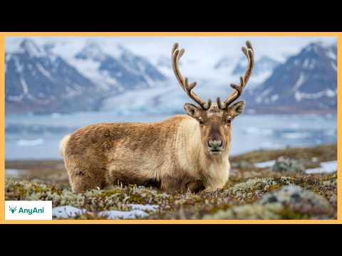
The presenter describes this Arctic archipelago halfway to the North Pole, more than 60% glaciated and underlain by permafrost, home to around 3,000 polar bears, Svalbard reindeer and walrus, with polar night and midnight sun.
- Austfonna ▶ 24:16
The presenter says Austfonna, covering about 8,100 square kilometres, is the largest ice cap on Svalbard and one of Europe's largest ice bodies outside Greenland, spilling into fjords as jagged ice fronts.
- Longyearbyen ▶ 27:20
The presenter notes that fewer than 3,000 residents live in Svalbard, primarily in the settlement of Longyearbyen, and that carrying a rifle outside communities is legally required because of polar bears.
- Hornsund ▶ 28:14
The presenter calls Hornsund in southern Svalbard one of the archipelago's most striking locations, where sharp peaks frame glacier fronts descending directly into dark Arctic water.
- Nordaustlandet ▶ 28:14
The presenter describes Nordaustlandet in the northeast as an almost continuous expanse of ice and tundra, rarely visited and largely inaccessible.
- Sognefjord ▶ 30:41
The presenter says Sognefjord stretches about 205 km inland from the North Sea, making it Norway's longest fjord, with a seabed roughly 1,308 m deep and granite walls rising over 1,000 m above the water.
- Geirangerfjord ▶ 32:23
The presenter describes Geirangerfjord as a narrower, dramatic fjord where snowmelt feeds waterfalls like the Seven Sisters, and notes it is UNESCO-listed as part of the West Norwegian Fjords.
- Seven Sisters Waterfall ▶ 32:23
The presenter says the Seven Sisters waterfall spills down a near-vertical wall in early summer, its streams separated by rock ribs shaped during glacial retreat.
- Nærøyfjord ▶ 33:01
The presenter notes Nærøyfjord narrows to about 250 m at its tightest point, with mountains towering some 1,700 m above sea level and sound amplified between the rock walls.
- Cairngorms National Park ▶ 36:07
The presenter describes the UK's largest national park, a territory of granite plateaus, glacial valleys and remnant Caledonian pine forest, with some of Britain's most severe weather and rare wildlife like ptarmigan and capercaillie.
- Ben Macdui ▶ 36:45
The presenter says Ben Macdui is the second-highest mountain in the United Kingdom at 1,309 m, built of granite formed around 400 million years ago during the Caledonian orogeny.
- Cairn Gorm ▶ 36:45
The presenter notes Cairn Gorm stands at 1,245 m and forms the heart of the park, with snow patches persisting into late summer in sheltered corries such as Garbh-choire Mòr.
- Loch Morlich ▶ 39:19
The presenter describes Loch Morlich as a glacial loch set beneath the northern slopes of Cairn Gorm, reflecting the surrounding peaks in still water on calm days.
- Fingal's Cave ▶ 41:03
The presenter describes this sea cave on the uninhabited island of Staffa, formed of hexagonal basalt columns, extending about 72 m into the island and 22 m high, whose echoes inspired Mendelssohn after his 1829 visit.
- Dolomites ▶ 45:13
The presenter describes the Dolomites as a fortress of pale dolomite rock that glows coral and amber at dawn and dusk (enrosadira), spanning roughly 16,000 square kilometres and UNESCO-listed since 2009.
- Marmolada ▶ 46:17
The presenter says Marmolada reaches 3,343 m and anchors the skyline, and that its glacier, though significantly reduced, remains the largest in the Dolomites.
- Tre Cime di Lavaredo ▶ 46:52
The presenter describes the Tre Cime di Lavaredo as three near-vertical monoliths whose north faces drop several hundred metres in almost uninterrupted planes, with freeze-thaw cycles feeding scree slopes below.
- Lago di Braies ▶ 47:48
The presenter says Lago di Braies reflects surrounding limestone peaks in intensely turquoise water coloured by suspended rock flour.
- Lago d'Orta ▶ 48:05
The presenter describes Lago d'Orta, perched at about 1,923 m, as displaying an opaque milky blue hue created by fine glacial sediments suspended in meltwater.
- Lago di Carezza ▶ 48:23
The presenter calls Lago di Carezza perhaps the most photographed lake in the Dolomites, renowned for reflecting the jagged Latemar massif and doubling the apparent height of the mountains.
- Danube Delta ▶ 51:31
The presenter describes the Danube Delta as a living labyrinth of channels, lakes and reed beds where the river fragments before the Black Sea, supporting over 300 bird species and protected as a UNESCO biosphere reserve.
- Carpathian Mountains ▶ 56:10
The presenter describes the Carpathians as an older, more secretive arc of forest and stone, reaching their highest point at Moldoveanu Peak in Romania and forming one of Europe's largest remaining natural woodlands.
- Moldoveanu Peak ▶ 56:30
The presenter notes Moldoveanu Peak as the highest point of the Romanian Carpathians, where alpine winds sweep across open grasslands above the tree line.
- Białowieża Forest ▶ 1:00:35
The presenter describes Białowieża Forest as one of Europe's last primeval lowland woodlands, with towering oaks and spruce, dead wood left where it falls, and free-ranging European bison reintroduced after extinction in the wild in 1919.
- Kainuu and Lapland taiga ▶ 1:06:11
The presenter describes the boreal taiga of Kainuu and Lapland as a quiet, persistent expanse of Scots pine and Norway spruce, with peat wetlands, open fells in Lapland, and wildlife including bears, wolverines and capercaillie.
- Finnish Lakeland ▶ 1:11:24
The presenter describes Finnish Lakeland as Europe's largest lake district, a labyrinth of more than 180,000 lakes shaped by the last ice age, with granite domes, eskers and the rare Saimaa ringed seal.
- Lake Saimaa ▶ 1:12:44
The presenter says Lake Saimaa covers approximately 4,400 square kilometres, branching into narrow channels, peninsulas and forested islands, and shelters the endangered Saimaa ringed seal in its protected inlets.
- Punkaharju Ridge ▶ 1:13:42
The presenter describes Punkaharju Ridge as a narrow esker arcing between two lakes, elevated just enough to offer uninterrupted views over water on both sides.
- Olavinlinna Castle ▶ 1:15:52
The presenter notes that medieval Olavinlinna Castle rises from a rocky islet in Savonlinna, blending into the surrounding lake system rather than dominating it.
- Monfragüe National Park ▶ 1:17:45
The presenter describes this Extremadura park of roughly 180 square kilometres, where the Tagus and Tiétar rivers cut quartzite ridges and gorges through dehesa woodland, supporting one of Europe's largest griffon vulture colonies.
- Salto del Gitano ▶ 1:18:24
The presenter calls Salto del Gitano the park's most iconic formation, a dramatic rock face rising nearly 300 m above the river, fractured into ledges and vertical seams.
Cities in these videos
Vatnajökull National Park · Landmannalaugar · Westfjords · Svalbard · Longyearbyen · Western Norway · Geiranger · Cairngorms National Park · Staffa · Dolomites · Tulcea County · Carpathian Mountains · Białowieża · Kainuu · Finnish Lakeland · Punkaharju · Savonlinna · Monfragüe National Park