 PlaceTube
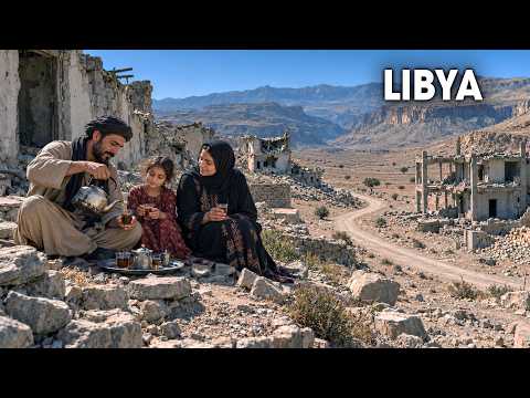
LIBYA: Inside The Country That The World Has Stopped Visiting | 4K Travel Documentary
Open in PlaceTube Watch on YouTube
Places in this video
- Red Castle (Assaraya Alhamra) Museum ▶ 2:25
A red fortress stranded beside the Mediterranean, cut off from the sea by a coastal road in the 1970s, now home to the National Museum that reopened in December 2025 after 14 years.
- Old Medina of Tripoli ▶ 3:47
The walled Medina behind the castle, restored by hand since late 2020 with no cement or concrete allowed, preserving traditional architecture.
- Copper Market (Souq al-Nahas) ▶ 4:18
Near the clock tower, metal workers still hammer pots into shape in this traditional market.
- Arch of Marcus Aurelius ▶ 4:20
A marble arch the Romans raised in the 160s, the only Roman monument left standing in the city center; it became Libya's first museum in 1919 and reopened in December 2025.
- Leptis Magna ▶ 5:10
A Roman emperor's hometown buried by 1,200 years of drifting sand until digging began in the 1920s; birthplace of Septimius Severus, guarded through the civil war by unpaid local men.
- Misrata ▶ 7:12
In the hills just inland from Misrata, some olive trees still bearing fruit are 600 years old, and in 2025 oil from Misrata won silver at an international competition.
- Ubari ▶ 8:25
An oasis town of about 30,000 known for its grapes, sitting at the edge of a sea of dunes with about 20 surviving lakes between them.
- Ubari Lakes ▶ 8:58
About 20 lakes survive between the dunes, but the water is becoming increasingly saline from evaporation; one lake is nearly five times as salty as seawater.
- Tkerkiba ▶ 10:45
The village closest to the lakes, from which a desert rally set off in January 2026, run with help from local people.
- Wadi Mathendous ▶ 11:49
A valley on the edge of the Messak Plateau where elephants, giraffes and crocodiles were carved thousands of years ago when this was grassland crossed by rivers.
- Tadrart Acacus ▶ 14:16
A range of rock towers southwest of Ubari along the Algerian border, called an open-air museum, where one family stayed to guard rock paintings spanning some 12,000 years.
- Ghat ▶ 17:21
A town beneath an old fortress on a hill, with a round old quarter of mud brick where a women's union restored a house into a public museum.
- Idinen ▶ 18:42
A mountain north of Ghat that locals call the home of the jinn, where explorer Heinrich Barth was rescued by a Tuareg rider in 1850.
- Ghat Festival ▶ 19:26
For three days each December the old streets fill with drums, indigo veils and camels; the festival supports local craftspeople and ends with a camel race.
- Apollonia ▶ 22:42
The harbor that served Cyrene, now partly on the seabed after the ground sank about 10 feet; a Greek theater with 28 rows of seats still faces the waves.
- Susa ▶ 24:16
The modern town wraps around the shore ruins; Storm Daniel's flash floods damaged or destroyed nearly eight in 10 of its buildings in one night in 2023.
- Derna ▶ 25:32
Rebuilding is about eight in 10 complete after the 2023 dam collapse sent floodwater through the city center; nine new bridges now cross the city, some turned into a public promenade.
- Jebel Akhdar ▶ 27:56
The "green mountain" plateau nearly 3,000 feet above the eastern coast, home to Phoenician juniper and mastic and more than half of the plants found only in Libya.
- Wadi al-Kuf Bridge ▶ 30:24
A cable-stayed bridge designed by Riccardo Morandi, opened in 1972, whose 925-foot central span was the longest of its kind for seven years and is the highest bridge in Libya.
- El Kouf National Park ▶ 31:44
Libya's largest protected area, reaching from forested hills down to beaches and lagoons around the Wadi al-Kuf valley.
- Great Man-Made River ▶ 32:40
A network of buried concrete pipes carrying fossil water from 1,300 desert wells north to the coast; by 1996 it reached Tripoli and now supplies about seven of every 10 gallons Libyans use.
- Ghadames ▶ 36:42
An old oasis town near the Tunisian and Algerian borders built around a single spring, with four-story mud-brick houses, covered shaded lanes and roof terraces reserved for women; taken off UNESCO's danger list in July 2025.
- Ain al-Faras ▶ 37:17
The spring that sustained Ghadames for over 2,000 years, whose water was divided among seven clans using a copper bowl called a caduce; legend says a traveler's horse pawed the ground and uncovered it.
- Nafusa Mountains ▶ 40:18
A range about 160 miles long inland from the western coast, where Amazigh villages sit packed together and families built stone walls across dry valleys to farm olives and grain.
- Qasr al-Haj ▶ 41:33
A round 13th-century storehouse at the northern foot of the Nafusa Mountains with 114 chambers around a courtyard, where families stored olive oil, barley and wheat and paid the owner a quarter of each harvest.
- Farwa Island ▶ 43:21
An empty sandbar about 8 miles long near the Tunisian border with a turquoise lagoon, where volunteers released rhim gazelles in 2024 and 2025 and watch over them with binoculars and drones.
- Waw an Namus ▶ 45:59
A volcano over 600 miles from Tripoli with a ring of black ash and three small lakes inside its crater, some tinted red; its name means the oasis of mosquitoes.
Cities in these videos
Tripoli · Khoms · Misrata · Ubari · Ghat · Susa · Derna · Bayda · Ghadames · Nalut · Zuwara · Murzuq