 PlaceTube
Driving Through Hokkaido’s Snowy High Pass | Mikuni Pass 4K
Open in PlaceTube Watch on YouTube
Places in this video
- Ryokushin Bridge ▶ 0:18
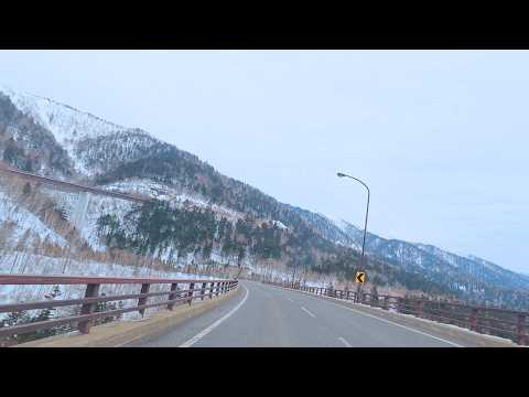
Ryokushin Bridge is seen in front of the Ishikari Mountains as the drive descends the pass.
- Matsumi Bridge ▶ 0:24
The red bridge visible below the road is Matsumi Bridge, pointed out from the left window.
- Komakusa Bridge ▶ 0:30
Komakusa Bridge is named among the bridges seen along the descent from Mikuni Pass.
- Mikuni Pass ▶ 0:42
The drive begins at Mikuni Pass on National Route 273, with views of the Higashi-Taisetsu Mountains and the Tokachi Mitsumata caldera basin.
- Mikuni Pass Observation Deck ▶ 0:42
The observation deck and its cafe are closed in winter, but the presenter stops for the mountain views before heading down the pass.
- Lake Nukabira ▶ 4:09
The presenter comes down to Lake Nukabira, where tents on the frozen lake suggest ice fishing and the ice still seems thick.
- Taushubetsu River Bridge ▶ 4:55
The concrete arch bridge is a remnant of the former Shihoro Line, in use until 1955 before Lake Nukabira was created; it is now gradually collapsing and can only be viewed from a distance.
- Sannosawa Bridge ▶ 5:28
Another remnant of the former Shihoro Line, from where Lake Nukabira can be seen more closely.
- Shikaoi ▶ 6:25
The route passes through Shikaoi, just beyond Kamishihoro, on the way to Lake Shikaribetsu.
- Ogigahara Observatory ▶ 7:08
The final stop is Ogigahara Observatory, where on clear days the Hidaka Mountains and the Pacific Ocean in the distance can be seen.
- Shirakaba Pass ▶ 7:40
The road narrows and steepens with snow on the surface as the drive heads down Shirakaba Pass toward Lake Shikaribetsu.
- Lake Shikaribetsu ▶ 8:20
The completely frozen lake, formed by volcanic activity, comes into view with Mount Tenbo ahead and ice up to a metre thick.
- Shikaribetsu Kotan Igloo Village ▶ 9:14
Set up on the frozen Lake Shikaribetsu in mid-winter, the village includes a Ceremony Igloo with a beautiful ice interior and a Geo Park Igloo.