 PlaceTube
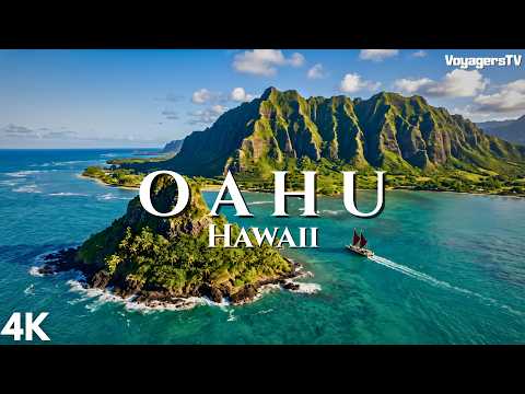
OAHU | Volcanoes, Kings and Hawaii's Wildest Coast | 4K Travel Documentary
Open in PlaceTube Watch on YouTube
Places in this video
- Waikiki ▶ 4:47
The presenter explains that Waikiki was once a wetland of taro terraces and fishponds, drained by a canal in the early 20th century and turned into the Pacific's most concentrated tourist district, and that it is also the birthplace of modern global surf culture via Duke Kahanamoku.
- Diamond Head ▶ 8:23
The crater looming over Waikiki, called Leahi by Hawaiians, was formed by an explosive steam eruption and later fortified by the US Army; its summit trail is the most walked on the island.
- Iolani Palace ▶ 11:55
The only royal palace ever built on American soil, raised by King Kalakaua in the 1880s, lit by electric light before the White House, and where Queen Liliuokalani was later imprisoned upstairs.
- Kawaiahao Church ▶ 15:36
A few streets from the palace, this church was built from slabs of coral cut by hand from the living reef offshore.
- Mauna Ala ▶ 15:36
The royal mausoleum in Nuuanu, behind iron gates, where most of the Hawaiian monarchs now rest.
- Chinatown ▶ 16:22
The district was deliberately burned in 1900 to stop plague and rebuilt almost immediately; the presenter uses it to tell the story of sugar-plantation immigration and Hawaii's creole culture and food.
- Manoa Falls ▶ 21:24
A trail through dripping forest and bamboo leads to a thin ribbon of water dropping about 150 feet down a dark rock face in Manoa Valley.
- Lyon Arboretum ▶ 21:49
Nearly 200 acres of the upper valley holding thousands of plant species, founded in 1918 by the Hawaiian Sugar Planters Association to learn how to regrow forests that hold water.
- Hanauma Bay ▶ 23:07
A volcanic crater whose seaward wall was breached by waves, now a sheltered coral-filled bay managed with reservations, a daily visitor cap and two rest days a week.
- Halona Blowhole ▶ 25:13
A lava tube on the black lava coast that funnels the swell upward into a blowhole, sending spray twenty feet into the air.
- Sandy Beach ▶ 25:24
Waves break directly onto the sand with enough force to break bones, which is exactly why bodysurfers love it.
- Koko Crater ▶ 25:52
A crater above the coast with the scar of an old tramway running straight up its flank like a ladder.
- Makapuu Point Lighthouse ▶ 26:08
At Oahu's easternmost tip stands a lighthouse burning since 1909, its light 420 feet above the sea and holding the largest lighthouse lens in the United States, roughly twelve feet tall.
- Rabbit Island ▶ 26:45
Offshore islets Manana, known as Rabbit Island, and Kaohikaipu beside it, both now seabird sanctuaries.
- Kailua Beach ▶ 27:27
Long before Honolulu existed, the centre of power on Oahu was here, thanks to fresh water, deep soil, safe canoe landings and a huge reliable food source; today it is pale sand and impossibly clear water.
- Kawainui Marsh ▶ 27:54
Hawaii's largest remaining wetland, about 830 acres, once a working fishpond ringed by taro terraces that fed a whole district.
- Ulupo Heiau ▶ 28:30
An enormous stone platform on a rise at the edge of the wetland, with walls up to about thirty feet, believed to have begun as an agricultural temple tied to the fishpond and fields.
- Lanikai Beach ▶ 29:27
Just around the point from Kailua, with the Mokulua islets offshore; reefs break the swell and the bay faces away from the wind, so the water behaves more like a lagoon than an ocean.
- Lanikai Pillbox Trail ▶ 30:02
Climbing the ridge above Lanikai passes WWII concrete observation posts and reveals the islets sitting in water that shifts through four distinct colours.
- Waimanalo ▶ 30:19
South along the coast, Waimanalo runs for miles, long and straight and noticeably quieter than anything to the north.
- Nuuanu Pali ▶ 30:40
The thousand-foot cliff where in 1795 Kamehameha's army pushed Oahu's defenders over the edge in the battle Kalelekaanae, the moment the islands stopped being separate kingdoms.
- Kaneohe Bay ▶ 33:58
The inside of a collapsed volcano, about seventeen square miles and the largest sheltered body of water in the main islands, with one of only two true barrier reefs in the archipelago.
- Ahu o Laka ▶ 35:34
A sandbar that surfaces in the middle of the bay at low tide, creating dry land for a few hours where there was none.
- Mokoli'i ▶ 35:55
A small pointed island at the northern end of the bay, known to most visitors by a nickname based on its shape.
- Kualoa Ranch ▶ 36:17
Ground reserved to the chiefs and connected with the voyaging chief Laamaikahiki; today a working ranch and film location whose cliffs are among the most recognisable images of Hawaii.
- Hoomaluhia Botanical Garden ▶ 37:08
Sits directly beneath the Koolau wall, its entrance road running straight at the cliffs and framing them so completely the mountains fill the windscreen.
- Byodo-In Temple ▶ 37:34
A scale replica of an eleventh-century hall at Uji in Japan, built without nails and dedicated in 1968 for the centenary of the first Japanese immigrants, with a three-ton brass bell and koi pond.
- Moli'i Fishpond ▶ 39:45
One of the largest surviving Hawaiian fishponds at around 125 acres, roughly 600 to 1,000 years old and still in use, where the tide feeds the fish through a sized wooden grate.
- Huilua Fishpond ▶ 40:03
A National Historic Landmark in Kahana Valley that was still being worked well into the twentieth century.
- Kahana Valley ▶ 40:59
One of the last places on Oahu where you can still see the shape of an ahupuaa, the traditional land division running from ridge to reef.
- Polynesian Cultural Center ▶ 41:30
A cultural centre opened in 1963 in Laie that now draws visitors by the million.
- Kahuku ▶ 41:38
A sugar mill ran here for eighty years and shut down in 1971; from here the coast faces open ocean with nothing between it and the far north Pacific.
- Waimea Bay ▶ 42:33
In summer a sheet of glass where families swim and children jump off the rock; in winter the same bay can kill you, and it is where big wave surfing began.
- Banzai Pipeline ▶ 43:43
The reef sits shallow and close to shore so waves stand up abruptly into an almost perfect hollow tube; the most photographed wave in the world and one of the most dangerous.
- Waimea Valley ▶ 45:19
Runs inland behind the bay with botanical gardens and a waterfall at the end, on ground cultivated and inhabited for centuries.
- Pu'u o Mahuka Heiau ▶ 45:37
The largest heiau on Oahu, about two acres on a bluff above Waimea Bay, built several hundred years ago, with the whole bay and the horizon the swells come from laid out below.
- Waialua Sugar Mill ▶ 46:20
The last sugar plantation on Oahu shut down in October 1996 after running since 1865; the building now houses small businesses, workshops and a coffee operation, with coffee and cacao on the old cane land.
- Haleiwa ▶ 47:33
A town that began as a plantation and railway settlement, its wooden storefronts and low awnings now filled with surf shops, shave ice and food trucks.
- Mokuleia ▶ 48:18
A long green shelf of land between the mountains and the sea with horse pastures, empty beaches and almost nothing built on it.
- Kawaihapai Airfield ▶ 48:33
A joint military and civilian field with a 9,000-foot runway, used mainly for gliders and skydivers towed up over the Waianae range; renamed Kawaihapai in 2024 under a long-term Army agreement.
- Ka'ena Point ▶ 50:48
The westernmost tip and emptiest place on Oahu, reached on foot along an old rail bed; a predator-proof fence protects nesting albatrosses and shearwaters, and a large stone marks the leaping place of souls.
- Kukaniloko Birthstones ▶ 53:39
About 180 stones in a field of red dirt at the exact centre of the island, for centuries the most important birthplace in Hawaii, where chiefly women came to give birth to children of the highest rank.
- Mount Ka'ala ▶ 56:30
Oahu's highest point at just over four thousand feet, its summit a flat, permanently waterlogged plateau holding a cloud forest and bog full of species found nowhere else.
- Makaha ▶ 57:27
One of four leeward valleys opening onto the coast; before the North Shore became the centre of the sport, Makaha was where big wave surfing was taken seriously and international competitions were run.
- Pearl Harbor ▶ 59:25
Once Puuloa, the richest water on the island with fishponds and pearl oysters, later the finest natural anchorage in the Pacific and the site of the 7 December 1941 attack that killed more than 2,400 people.
- USS Arizona Memorial ▶ 1:01:18
The memorial stands across the hull of the Arizona without touching it; 1,177 men died aboard her and oil still rises from the wreck and spreads across the surface.
- National Memorial Cemetery of the Pacific ▶ 1:01:36
In Punchbowl crater, called Puowaina or hill of sacrifice, a place of execution before Western contact and a national cemetery since 1949, whose first burial was an unknown serviceman killed at Pearl Harbor.
Cities in these videos
Honolulu · Kailua · Waimanalo · Kaneohe · Kahana · Laie · Kahuku · Haleiwa · Waialua · Wahiawa · Waianae · Makaha