 PlaceTube
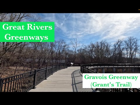
Gravois Greenway: Grant's Trail tour: (St. Louis, MO)
Open in PlaceTube Watch on YouTube
Places in this video
- Gravois Greenway (Grant's Trail) ▶ 0:17
The ride starts at mile marker zero of the Gravois Greenway, also known as Grant's Trail, where it meets the River Des Peres Greenway near Interstate 55.
- River Des Peres Greenway ▶ 0:17
The Gravois Greenway intersects with the River Des Peres Greenway at the start of the ride; a new bridge completed in 2020 connects the two trails.
- Kirkwood ▶ 2:02
The trail ends just on the other side of Highway 44 in the city of Kirkwood, the northern terminus of the ride.
- Bayless Avenue Bridge ▶ 2:33
A 600-foot pedestrian and bicycle bridge lets trail users cross four lanes of Bayless Avenue without stopping; the presenter warns against leaving the trail here due to poor sidewalks.
- Gravois Creek Wetland Boardwalk ▶ 3:36
A new elevated boardwalk bridge crosses a restored wetland off Gravois Creek, cleaned of garbage and planted with native pollinator plants to filter the water.
- Orlando's Event Center ▶ 4:17
The new section of trail ends next to Orlando's Event Center, a former starting point that is now a rest area with bathrooms, water, a play structure, a bike pump and picnic seating.
- Reavis Barracks Road Trailhead ▶ 5:50
After crossing Reavis Barracks Road, there is a trailhead on the right with a bathroom, parking and a water fountain.
- Union Road Trailhead ▶ 7:48
Union Road is a trailhead with parking and picnic benches; it is a shady spot but sits under a highway.
- Bottomland Trail ▶ 9:10
Over a half mile the presenter passes three trailheads for the Bottomland Trail, a walking path a little over half a mile long that loops briefly through the woods.
- Twin Bridge Trail ▶ 9:48
The Twin Bridge Trail branches left and climbs 100 feet over half a mile to Blake C. Snyder Park.
- Blake C. Snyder Park ▶ 9:48
Reached via the Twin Bridge Trail, the park has restrooms, two softball fields, a playground and short hiking and biking trails.
- Tesshire Drive Trailhead ▶ 10:11
Just before Tesshire Drive there is another trailhead with parking along the former Kirkwood-Carondelet branch railroad line.
- Affton Athletic Fields ▶ 10:45
To the left are the Affton athletic fields with many baseball and softball fields, plus the Affton Ice Rink; trail users can park here.
- Grant's Farm ▶ 11:56
Immediately after crossing Gravois Road is Grant's Farm, owned by the Busch family since 1903; entry is free except a $15 parking fee, and a tram tour shows animals and the Busch family home.
- Ulysses S. Grant National Historic Site ▶ 12:31
On the right is the Ulysses S. Grant National Historic Site, home of Whitehaven, where Grant met his wife Julia Dent; inside you can learn about the Grant and Dent families.
- Whitehaven ▶ 12:31
The home known as Whitehaven, where Grant met his wife Julia Dent and where the couple planned to spend their retirement years.
- Budweiser Clydesdale Stables ▶ 13:16
Behind the white fence on the left are the world-famous Budweiser Clydesdales, sometimes close enough for a photo.
- Watson Road Industrial Park Trailhead ▶ 14:55
A ramp on the left leads to another trailhead with parking, called the Watson Road Industrial Park trailhead.
- Sappington House ▶ 15:32
A brick home built by Thomas Sappington in 1808, one of only a few homes from that era still standing; its parking lot also serves as a trailhead.
- The Barn ▶ 15:32
The restaurant next door to the Sappington House, sharing its parking lot with the greenway trailhead.