 PlaceTube
UNSEEN NEW ENGLAND: The Oldest Corner of America
Open in PlaceTube Watch on YouTube
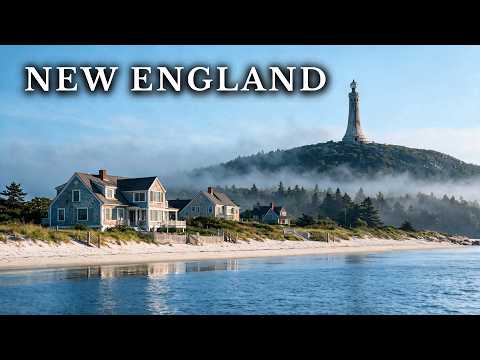
Places in this video
- Acadia National Park ▶ 1:54
The video introduces Acadia as one of the few national parks the government never bought, created by wealthy preservationists and local families to save the island from overdevelopment.
- Jordan Pond ▶ 3:45
The presenter describes Jordan Pond as 120 feet deep, incredibly clear, and the drinking water source for Seal Harbor, so swimming is strictly prohibited.
- Bass Harbor Head Light ▶ 4:55
The video notes this lighthouse has shown red over the same ledge since 1858 and that the Coast Guard still runs its beam today.
- Sand Beach ▶ 6:13
The presenter explains that this beach's sand is 70 to 80 percent ground shell, and that J.P. Morgan bought it as a wedding present for his daughter before it was donated to the park.
- Cadillac Mountain ▶ 7:30
The video describes Cadillac Mountain as the highest point on the Atlantic coast of the United States, where the first sunlight to reach the mainland touches the summit from October to March.
- Kent Falls State Park ▶ 8:23
The presenter says Kent Falls plunges 250 feet in under a quarter mile, was gifted to the government by a conservationist in 1919, and swimming is not allowed due to slippery rocks and steep drops.
- Castle Hill (Crane Estate) ▶ 9:17
The video explains that Richard Crane bought the land in 1910 and built a 59-room mansion with a half-mile lawn, with rooms shipped in from demolished English houses.
- Cape Cod ▶ 11:18
The presenter describes Cape Cod's shallow sand bars as notorious for more than 3,000 shipwrecks, and notes it was named for the codfish and hosted the first public two-way wireless communication between the US and Europe.
- Nauset Lighthouse ▶ 12:45
The video says the original three towers, the three sisters of Nauset, collapsed into the sea, and the lighthouse standing today was reused from another part of Cape Cod.
- Sandy Neck Beach ▶ 14:02
The presenter describes wind-sculpted dunes 50 to 70 feet high, private cottages without road access, and ranger-led convoys that stop when piping plover chicks hatch.
- Ipswich Marshes ▶ 15:27
The video explains that federal crews cut 1,500 miles of drainage ditches in the 1930s, and that overfishing let marsh crabs dominate and collapse the creek banks.
- Martha's Vineyard ▶ 18:36
The presenter says a short ferry ride connects the mainland to the island, which was named after wild grapevines and the explorer's daughter, and where a sign language developed in Chilmark.
- Aquinnah Cliffs ▶ 20:16
The video describes the clay cliffs held by the Wampanoag for thousands of years, with colorful stripes said in folklore to be stained by the blood of a sea monster.
- Woodford ▶ 21:46
The presenter describes this settlement that fed itself by burning its forest into charcoal, now left with stone walls, cellar holes, and a burying ground the forest has reclaimed.
- Mount Katahdin ▶ 22:57
The video says Katahdin means greatest mountain in Penobscot, is the highest ground in the state, and has a famous ridge called the knife edge.
- Baxter State Park ▶ 24:18
The presenter explains that a former governor spent 30 years assembling the wilderness that became Baxter State Park, on the condition it remain wild forever.
- Compass Pond ▶ 24:36
The video describes roughly 100 acres of Compass Pond outside the park's southern gate, where the mountain is reflected on the water, with no electricity or cell coverage.
- Madame Sherry's Castle ▶ 27:22
The presenter says these ruins belong to a French-style summer house laid out in 1930 without a blueprint by a New York costume designer, now reduced to foundations, chimneys, and arches.
- Mystic Seaport ▶ 28:31
The video describes the village's whale ship, the last wooden whale ship in the world, and notes the yards turned out 56 steamers during the Civil War.
- Mystic River Bascule Bridge ▶ 30:47
The presenter says US Route 1 crosses the river via this famous bascule bridge, which opens about six times a day and stops traffic each time.
- Mount Greylock ▶ 31:23
The video says Mount Greylock is the highest natural point in Massachusetts, home to a unique balsam fir and red spruce forest, and that its profile inspired Melville's Moby Dick.
- Veterans War Memorial Tower ▶ 32:49
The presenter describes the tower's beacon as visible up to 70 miles across three states, and says the state shuts it down during migration seasons to protect birds.
- Bascom Lodge ▶ 32:55
The video notes the lodge beside the tower was named after John Bascom, an early Greylock reservation commissioner who advocated for preserving the summit.
- Seaside Sanatorium ▶ 34:32
The presenter describes this abandoned seaside sanatorium, America's first facility dedicated to heliotherapy, where children with tuberculosis were treated with sunlight.
- Mount Washington ▶ 36:03
The video says Mount Washington is famous for extreme, unpredictable weather, with a record wind chill of -102.59 F and observatory buildings chained to the rocks.
- Penfield Reef Lighthouse ▶ 37:25
The presenter describes the reef as the most dangerous place on Long Island Sound in fog or snow, and tells how keeper Frederick Lawson drowned just yards from home in 1916.
- Quechee Gorge ▶ 38:34
The video describes this mile-long gorge carved about 13,000 years ago by the retreating Laurentide Ice Sheet, crossed by a steel arch highway bridge.
- Quechee Village ▶ 39:53
The presenter says the village grew around a drop in the Ottauquechee River where mills ran for two centuries, and a glassmaker later ran furnaces off the same falls.
- Quechee Covered Bridge ▶ 40:45
The video says Tropical Storm Irene nearly destroyed this historic bridge in 2011, and a longer span was built a year later to let the next flood through.
- Norton Paper Mill Ruins ▶ 42:48
The presenter describes the mill that ran for nearly a century until a July fire left only brick walls, and the town bought the site for $1 and spent over a decade restoring it.
- Quabbin Reservoir ▶ 43:55
The video explains that four towns were disincorporated in 1938 to create the reservoir, which holds over 400 billion gallons and helped bring bald eagles back to Massachusetts.
- Waterplace Park ▶ 47:16
The presenter says Providence uncovered and restored its buried rivers and built Waterplace Park, still celebrated today.
- Rhode Island State House ▶ 47:31
The video describes the State House's self-supporting white Georgia marble dome, the Independent Man statue on top, and the Royal Charter of 1663 on display inside.
- Point Judith Lighthouse ▶ 49:01
The presenter says this granite tower has lit the point since the 1850s, and that a German submarine sank a coal ship here in the last naval engagement of World War II.
- Misquamicut Beach ▶ 50:23
The video says three hurricanes in under two decades flattened almost every building here, but the community rebuilt each time and still draws over a million visitors a year.
- Candlewood Lake ▶ 51:09
The presenter describes Connecticut's largest lake, created in the 1920s by flooding a valley, with the ghost town of Jerusalem beneath the water.
- Stowe Community Church ▶ 55:00
The video calls the church iconic with its 75-foot spire and Greek Revival architecture, listed on the National Register of Historic Places.
- Lake Champlain ▶ 55:23
The presenter describes the 120-mile lake filling a glacial valley, a military highway in the Revolutionary War and War of 1812, with about 300 preserved shipwrecks on its bed.
- Burlington Breakwater Lights ▶ 57:18
The video says the lights stand at the ends of a stone and timber breakwater built to protect the harbor, and the current lights are replicas.
- Bennington Battle Monument ▶ 59:41
The presenter describes the 306-foot stone obelisk, the tallest structure ever built in Vermont, erected to mark the victory over the British.
- Pond Island Lighthouse ▶ 1:00:30
The video says this is one of the shortest beacons on the Maine coast, established in 1821, still without commercial electricity or indoor plumbing.
- Lake Willoughby ▶ 1:01:33
The presenter calls it the Norwegian fjord of Vermont, the state's deepest lake at just over 308 feet, framed by steep cliffs and known for clear blue water.
- Mount Pisgah ▶ 1:03:46
The video says peregrine falcons reclaimed the cliffs of Mount Pisgah in 1984 and bred successfully there again the following year.
- Pleasure Beach ▶ 1:04:40
The presenter describes the abandoned seaside park that once had a carousel, roller coaster, and ballroom, closed after fires and demolished in 2010.
- Mount Mansfield ▶ 1:06:04
The video describes Mount Mansfield's nearly 4,400-foot summit called the chin, its fragile alpine tundra, and the dangerous cliff trail through a rock squeeze called the keyhole.
- Hearthstone Castle ▶ 1:08:41
The presenter says this stone castle was built in 1897 as a summer home for a portrait photographer, and now stands in ruins among the trees.
- Townshend Dam ▶ 1:09:44
The video explains the 1930s dams built to hold back the West River, and that Townshend alone held back 10.8 billion gallons of water during later floods.
- West Dummerston Covered Bridge ▶ 1:10:46
The presenter describes this 1872 covered bridge with two wooden lattice spans that still carries vehicles today, despite storm and truck damage.
- Black Rock Harbor Lighthouse ▶ 1:12:14
The video says this stone lighthouse was completed in 1823, and keeper Kate Moore tended its lamps for decades and saved at least 21 lives.
- Salem ▶ 1:14:02
The presenter describes Salem as a wealthy trading port whose notorious witchcraft chapter began in 1692, and today a global capital for Halloween tourism.
Cities in these videos
Bar Harbor · Tremont · Kent · Ipswich · Provincetown · Eastham · Barnstable · Martha's Vineyard · Aquinnah · Woodford · Millinocket · Derry · Mystic · Adams · Milford · Sargent's Purchase · New London · Quechee · Royalston · Belchertown · Providence · Narragansett · Westerly · New Milford · Stowe · Burlington · Bennington · Georgetown · Westmore · Bridgeport · Danbury · Townshend · Dummerston · Salem