 PlaceTube
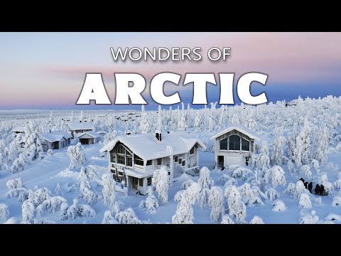
Wonders of the Arctic | Earth's Last Great Wilderness | Travel Documentary 4K
Open in PlaceTube Watch on YouTube
Places in this video
- Reinebringen ▶ 3:28
The presenter describes the steep stone-step trail climbing 1,500 feet to the summit, with sweeping views over the archipelago and red fishing cabins below.
- Henningsvær ▶ 4:21
Called the Venice of Lofoten, this fishing village of about 500 residents spreads across small islands connected by bridges, with colorful buildings, galleries and cafes around the harbor.
- Nusfjord ▶ 5:09
A preserved fishing village essentially unchanged since the 1800s, with red rorbuer cabins and authentic fish oil factories and net houses operating as a living museum.
- Reine ▶ 6:06
The presenter describes this fishing village with red rorbuer cabins on stilts above the fjord, surrounded by granite mountains and bathed in midnight sun or northern lights.
- Sakrisøy ▶ 7:29
A tiny settlement of traditional red cabins on rocky outcrops, with wooden cod-drying racks called hjell and a bridge linking it to neighboring islands.
- Hamnøy Bridge ▶ 8:18
The presenter describes this graceful bridge curving over the water, connecting isolated settlements and offering a famous photo spot of red cabins, peaks and Arctic water.
- Kvalvika Beach ▶ 9:24
A remote white-sand beach trapped between towering granite cliffs, reachable only by a two-hour hike from near Fredvang through boggy moorland and rocky ridges.
- Ryten Mountain ▶ 11:00
The presenter describes this 1,770-foot granite peak overlooking Kvalvika Beach, whose summit offers a perfect crescent view of sand between cliffs and ocean.
- Fredvang Bridges ▶ 11:50
Two curved spans built in the 1980s connect Flakstadøya and Moskenesøya, replacing old ferry routes and framing views of mountains plunging into the sea.
- Segla Mountain ▶ 13:38
Senja's most recognizable landmark, a sharp 639-meter summit resembling a ship's sail frozen in stone, reached by a four-hour climb above deep fjords.
- Ersfjordstranda Beach ▶ 14:24
A nearly mile-long white-sand beach with turquoise water on Senja's outer coast, where surfers ride swells under the midnight sun and peaks glow pink at twilight.
- Tungeneset Viewpoint ▶ 15:10
A wooden platform extending over the cliff edge facing the open ocean, a prime spot to watch the aurora borealis reflected in the water below.
- Bleik Beach ▶ 16:36
A long white-sand beach on Andøya's northwestern shore, backed by grass-covered dunes, where Arctic terns nest, seals rest offshore and the midnight sun glows.
- Andenes Lighthouse ▶ 17:21
A red iron tower built in 1859 rising 130 feet at the island's northern tip, with a small maritime museum in the keeper's quarters and views toward the Arctic Ocean.
- Whale Safari Andenes ▶ 18:04
Safari boats launch year-round from the fishing town to see sperm whales, orcas, humpbacks and pilot whales in deep canyons just offshore.
- Saltfjellet–Svartisen National Park ▶ 18:50
A protected wilderness straddling the Arctic Circle, where ancient glacial ice grinds against granite peaks and reindeer migrate along age-old paths.
- Svartisen Glacier ▶ 19:41
Norway's second-largest ice mass, covering 142 square miles, its dark blue compressed ice feeds tongues that creep down valleys toward the sea.
- Engabreen ▶ 20:22
Svartisen's most accessible glacier arm, descending nearly to sea level with a face rising 130 feet and milky blue meltwater streams pouring from beneath.
- Saltstraumen ▶ 22:31
The world's strongest maelstrom, where 400 million cubic meters of seawater force through a 150-meter channel four times daily, creating whirlpools up to ten meters wide.
- Saltstraumen Bridge ▶ 23:57
A 768-meter cantilever bridge built in 1978 crossing 30 meters above the churning strait, where visitors watch the maelstrom from the pedestrian walkway.
- Bodø ▶ 24:50
The gateway city to Saltstraumen, a peninsula city of 50,000 rebuilt after WWII, with midnight sun in summer and northern lights over the harbor in winter.
- Narvik ▶ 25:47
An Arctic city founded in 1902 as an iron ore port where the Ofotfjord meets towering mountains, with WWII history and cable cars climbing the mountainsides.
- Lyngen Alps ▶ 28:27
A mountain range along Norway's northern coast with peaks over 6,000 feet, bathed in midnight sun in summer and aurora in winter.
- Lyngseidet ▶ 29:18
A small village at the base of the Lyngen Alps where traditional Sami culture thrives and reindeer herders follow ancient migration routes.
- Blåisvatnet ▶ 29:57
Known as Blue Lake for its striking turquoise glacier-fed waters, surrounded by steep mountain walls and reachable only by hiking trails through birch forests.
- Steindalsbreen Glacier ▶ 30:37
A river of ancient ice flowing down from the high peaks, its crevasses revealing compressed blue ice and feeding waterfalls that tumble down cliff faces.
- North Cape ▶ 31:36
Europe's northernmost point, a 1,007-foot cliff of dark granite rising above the Arctic Ocean, reachable by road and battered by polar winds.
- Nordkapp Globe Monument ▶ 32:04
A metal sphere installed in 1978 marking the geographic milestone, its iron framework tracing latitude and longitude lines, touched by visitors from around the world.
- North Cape Hall ▶ 32:53
A partially underground visitor center on the clifftop with exhibits, a chapel, the world's northernmost post office and glass-protected viewing terraces.
- Alta Canyon ▶ 33:49
One of Northern Europe's most dramatic gorges, carved by the Alta River through Finnmark tundra, with walls revealing millions of years of rock layers.
- Alta Canyon Viewpoint ▶ 34:34
A vantage point high above the river offering unobstructed views across the gorge, where vertical walls drop hundreds of feet to the rushing water.
- Honningsvåg ▶ 35:42
A small town on Magerøya Island, closer to the North Pole than Oslo, whose harbor is the gateway to Europe's northernmost point and supports king crab and cod fishing.
- Skarsvåg ▶ 37:15
The world's northernmost fishing village, home to just 150 people whose houses huddle against fierce Arctic storms and whose families have fished for generations.
- Hammerfest ▶ 38:14
One of the world's northernmost cities, clinging to Kvaløya island at 70 degrees north, rebuilt after WWII and thriving despite two months of polar night.
- Meridian Column ▶ 38:55
A stone pillar marking Hammerfest's role in the first international scientific effort to measure Earth's exact shape and size between 1816 and 1855.
- Hammerfest Church ▶ 39:31
A 1961 triangular concrete church replacing the original destroyed in 1945, with stained glass windows casting colored light across wooden pews.
- Salen Mountain Viewpoint ▶ 40:11
A zigzag stairway of 600 steps climbs to 80 meters above sea level, offering views over Hammerfest and the Barents Sea, with aurora overhead on winter nights.
- Longyearbyen ▶ 40:56
The world's northernmost settlement of significant size, at 78 degrees north, where 2,000 people live under rules unlike anywhere else and polar bears outnumber humans.
- Svalbard Museum ▶ 41:34
A museum telling four centuries of Arctic survival through whaling tools, mining equipment and preserved wildlife specimens.
- Global Seed Vault ▶ 42:16
A concrete fortress burrowed into the permafrost holding nearly a million seed samples at -18°C as humanity's agricultural insurance policy.
- Adventfjorden ▶ 42:57
A 14-mile fjord serving as Longyearbyen's maritime gateway, where belugas and seals navigate in summer and the shoreline reveals fossils from ancient tropical forests.
- Ilulissat ▶ 43:48
A Greenlandic town at the mouth of the Kangia Icefjord, 250 miles north of the Arctic Circle, where 4,500 people live alongside a frozen river of icebergs.
- Ilulissat Icefjord Centre ▶ 44:37
An architectural marvel rising from the tundra, with exhibitions on 4,000 years of human adaptation and floor-to-ceiling windows facing the calving icefjord.
- Kangia Icefjord Boat Tour ▶ 45:09
Small vessels weave between towering icebergs in the icefjord, where seals surface between floes and the glacier behind moves 40 meters each day.
- Sermermiut ▶ 46:14
An archaeological site near Ilulissat preserving 4,000 years of habitation by the Saqqaq, Dorset and Thule peoples, with tent rings, house depressions and middens.
- Kangerlussuaq ▶ 48:28
A small settlement at the head of a 190-kilometer fjord, once a US military base and now western Greenland's main air hub and gateway to the ice sheet.
- Russell Glacier ▶ 48:54
An active glacier flowing from the Greenland ice sheet, advancing about 25 meters a year, with a face rising 60 meters and deep crevasses and meltwater channels.
- Point 660 ▶ 49:52
The spot where solid ground gives way to the edge of the ice sheet, with ice stretching endlessly eastward over two kilometers thick in places.
- Sisimiut ▶ 51:48
An Arctic settlement just north of the Arctic Circle where 5,600 people live between frozen sea and granite mountains, with colorful houses on stilts above permafrost.
- Ittoqqortoormiit ▶ 54:10
One of the most remote settlements on the planet, with just under 500 people living on the edge of Scoresby Sound, where dog sleds remain essential and no roads connect to the outside.
- Jökulsárlón Glacier Lagoon ▶ 56:37
A glacial lake formed less than a century ago as Breiðamerkurjökull retreated, now over seven square miles, where icebergs drift toward the Atlantic.
- Diamond Beach ▶ 57:16
Black volcanic sand covered with chunks of crystal-clear glacier ice polished by waves until they gleam like precious stones against the dark shore.
- Jökulsárlón Zodiac Boat Tours ▶ 57:54
Small inflatable boats carry visitors between floating icebergs, some glowing intense blue from centuries of compression, with seals surfacing nearby.
- Fjallsárlón Lagoon ▶ 58:43
A quieter, smaller lagoon closer to the glacier's edge, where icebergs crowd together and the glacier face rises directly from the water.
- Vatnajökull National Park ▶ 59:51
One of Europe's largest national parks, covering nearly 14% of Iceland, where Europe's most massive glacier conceals active volcanoes beneath ancient ice.
- Skaftafell Ice Cave ▶ 1:00:49
Natural ice tunnels carved by meltwater beneath the glacier, where centuries-old ice filters sunlight into glowing shades of sapphire and turquoise.
- Svartifoss Waterfall ▶ 1:01:30
A waterfall plunging 80 feet between hexagonal black basalt columns that inspired the design of Iceland's National Theatre and Hallgrímskirkja church.
- Hvannadalshnúkur ▶ 1:02:02
Iceland's highest peak at 6,923 feet, emerging from the Öræfajökull glacier, where climbers stand at the roof of Iceland above glacial valleys and volcanic craters.
Cities in these videos
Moskenes · Vågan · Flakstad · Senja · Andøy · Rana · Bodø · Narvik · Lyngen · Nordkapp · Alta · Hammerfest · Longyearbyen · Ilulissat · Kangerlussuaq · Sisimiut · Ittoqqortoormiit · Hornafjörður