 PlaceTube
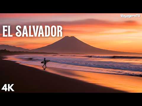
EL SALVADOR: Where Fire Meets the Pacific | Volcanoes, Waves and a Country Rewritten
Open in PlaceTube Watch on YouTube
Places in this video
- Santa Ana Volcano ▶ 3:59
The presenter describes Ilamatepec, El Salvador's highest volcano, with a turquoise steaming crater lake reached by a two-hour hike through cloud forest from Cerro Verde National Park.
- Cerro Verde National Park ▶ 4:44
The trail to Santa Ana begins in this protected park embracing three volcanic peaks; Cerro Verde's forested slopes have orchid-lined walking trails and ridgeline views.
- Izalco Volcano ▶ 5:39
The video calls Izalco the youngest volcano in El Salvador, once glowing so constantly that sailors used it as the Lighthouse of the Pacific.
- Lake Coatepeque ▶ 6:43
A caldera lake that periodically turns vivid turquoise, ringed with restaurants and docks where visitors rent boats; the presenter explains its mineralization and the 2026 astronaut photo.
- Isla del Cerro (Isla Teopán) ▶ 9:52
A small lava-dome island rising from the floor of Lake Coatepeque, adding mystery to the caldera scene.
- Joya de Cerén ▶ 11:28
A Maya farming village buried by volcanic ash around 600 AD and accidentally uncovered in 1976, preserving homes, gardens and belongings; UNESCO calls it the Pompeii of the Americas.
- Tazumal ▶ 14:49
El Salvador's tallest Maya pyramid, over three thousand years old, with links to Teotihuacan, Copán and Chichen Itza and a small on-site museum.
- Casa Blanca ▶ 17:24
Another Maya site within walking distance of Tazumal, with five pyramids of its own.
- Cihuatán ▶ 17:30
Possibly the largest pre-Columbian site in the country, with ballcourts, palaces, pyramids and defensive walls, much still unexcavated.
- Santa Ana Cathedral ▶ 19:10
A neo-Gothic masterpiece completed in 1913, its stone-carved towers rising above the central plaza with a still, inviting interior.
- Teatro de Santa Ana ▶ 19:37
A neoclassical theater with a pastel-green facade across the plaza, one of the country's most photographed buildings and host to performances.
- Ruta de las Flores ▶ 21:00
A highland road linking Nahuizalco, Salcoatitán, Juayúa, Apaneca and Concepción de Ataco through coffee plantations, flowered hillsides and misty forests.
- Juayúa ▶ 21:43
Famous for its weekend food festival, when the town center fills with tents selling grilled meats, seafood, pupusas and tropical drinks alongside live music.
- Concepción de Ataco ▶ 22:18
A town of colorful murals, artisan workshops and lively weekend nightlife, its cobblestone streets lined with galleries, cafes and craft shops.
- Nahuizalco ▶ 22:40
Home to the largest remaining Pipil population, preserving traditions and crafts, and carrying the memory of the 1932 massacre.
- Museo Comunitario Nahuat Pipil ▶ 22:59
A free community museum telling the story of the 1932 indigenous massacre; a ten-minute visit that stays with you far longer.
- Cascada la Golondrinera ▶ 23:32
A hidden waterfall at the end of a short hike through a narrow river canyon, one of El Salvador's best-kept secrets.
- Apaneca ▶ 24:16
Sits among the highest points of the Flower Route, surrounded by cloud forest and cooler temperatures, a world away from the Pacific coast.
- San Salvador ▶ 25:00
The capital is presented as a city reborn, with volcanic peaks framing the skyline, modern towers beside colonial landmarks, and street vendors on every corner.
- Palacio Nacional ▶ 25:41
Anchors the main plaza with neoclassical columns and a history of fires and earthquakes; tours reveal the layers of national history.
- Metropolitan Cathedral ▶ 26:09
A place of worship and memory closely tied to Archbishop Óscar Romero, whose legacy still echoes through the country.
- El Rosario Church ▶ 26:36
A brutalist concrete shell outside, but inside sunlight through colored glass casts shifting rainbows; designed in the 1960s by Rubén Martínez.
- San Benito ▶ 27:14
An upscale capital neighborhood of fine restaurants, wine bars and modern cafes, including the acclaimed El Xolo.
- El Xolo ▶ 27:33
Recognized as one of Latin America's best restaurants, blending Salvadoran ingredients with contemporary technique.
- El Boquerón National Park ▶ 27:57
Sits atop an ancient volcano with an enormous main crater holding a smaller crater, El Boqueróncito, and views across the capital.
- El Tunco ▶ 29:20
A tiny two-street surf village with black sand, legendary sunsets and clockwork surf breaks, where shoes are optional and the day follows the tide.
- El Zonte ▶ 30:10
The quieter heart of Surf City El Salvador, with beach cafes, ocean-view coffee and sunrise yoga along the shore.
- El Sunzal ▶ 30:29
Offers some of the most technical and respected surf breaks in the country, spoken of with reverence by experienced surfers.
- Punta Mango ▶ 31:00
One of the eastern point breaks forming the backbone of the World Surfing Reserve, consistent and beautifully uncrowded.
- Playa El Cuco ▶ 31:00
An eastern surf beach where conservation programs let travelers join baby sea turtle releases.
- Playa Las Flores ▶ 31:00
Part of the eastern World Surfing Reserve, with consistent, uncrowded point breaks.
- Bahía de Jiquilisco ▶ 31:39
Fringed by El Salvador's largest mangrove forests, where ospreys and pelicans nest and hawksbill turtles return to lay eggs.
- Los Cóbanos ▶ 32:24
Reefs with parrotfish, rays, eels and turtles, plus the wreck of the SS Douglas, a coffee freighter sunk in 1980; humpback whales pass between November and April.
- Suchitoto ▶ 33:32
A colonial hillside town overlooking Lake Suchitlán, abandoned during the civil war and reborn as a cultural destination with arts festivals and galleries.
- Santa Lucía Church ▶ 34:05
A white-walled church overlooking a plaza where daily life unfolds with quiet beauty.
- Los Tercios Waterfall ▶ 34:26
A waterfall dropping over perfectly hexagonal basalt columns formed by ancient lava, with a pool deep enough to swim in.
- Laguna de Alegría ▶ 34:56
A tiny emerald-green crater lake inside a dormant volcano, called the Emerald of the Americas, reached by a short but steep hike.
- Puerta del Diablo ▶ 35:29
Two massive boulders framing a natural window over Panchimalco, Lake Ilopango, San Vicente Volcano and the Pacific, with over sixty climbing routes nearby.
- Lake Ilopango ▶ 36:07
A giant seventy-two-square-kilometer caldera lake formed by a catastrophic eruption around 410-535 AD that may have caused global cooling and famine.
- Conchagua Volcano ▶ 36:45
Offers what many call El Salvador's finest sunrise, looking over the Gulf of Fonseca where El Salvador, Honduras and Nicaragua meet.
- Montecristo National Park ▶ 37:06
Protects a cool, damp cloud forest in the far north where three countries converge, with wildlife rivaling Costa Rica.
- Olocuilta ▶ 39:08
Widely considered the birthplace of the pupusa, just fifteen minutes from the international airport.
Cities in these videos
Santa Ana · San Juan Opico · Chalchuapa · San Salvador · Juayúa · Concepción de Ataco · Nahuizalco · Apaneca · La Libertad · San Miguel · Jiquilisco · Acajutla · Suchitoto · Alegría · Panchimalco · Ilopango · La Unión · Metapán · Olocuilta