 PlaceTube
Iceland's Most Dangerous Waterfall is Not The One You Expect
Open in PlaceTube Watch on YouTube
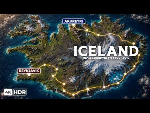
Places in this video
- Akureyri ▶ 0:40
The video introduces Akureyri as Iceland's northern capital and second largest urban area, sitting at the head of Iceland's longest fjord just south of the Arctic Circle.
- Akureyrarkirkja ▶ 2:23
The presenter describes Akureyrarkirkja dominating the town from its hill, designed by Guðjón Samúelsson and completed in 1940, with twin towers and stained glass including a window from old Coventry Cathedral.
- Goðafoss ▶ 3:34
Goðafoss, the waterfall of the gods, is shown as a 12 m high, 30 m wide horseshoe cascade where the law speaker threw his pagan idols after Iceland adopted Christianity in the year 1000.
- Dettifoss ▶ 6:56
Dettifoss is presented as Europe's most powerful waterfall by volume, dropping 45 m into the Jökulsárgljúfur canyon with roughly 193,000 liters per second and deafening roar and mist.
- Seyðisfjörður ▶ 11:00
The video describes Seyðisfjörður as a colorful, isolated fishing village of 700 at the head of a 17 km fjord, reached over a 630 m mountain pass and home to the ferry from Europe.
- Seyðisfjarðarkirkja ▶ 12:10
The blue church built in 1922 in Norwegian style is highlighted, along with the rainbow path painted to its entrance in 2016 that became an iconic photo spot.
- Vatnajökull ▶ 14:16
Vatnajökull is described as Europe's largest ice cap by volume, covering about 8% of Iceland atop active volcanoes, feeding over 30 outlet glaciers and winter ice caves.
- Jökulsárlón ▶ 17:55
Jökulsárlón glacier lagoon is shown as Iceland's deepest natural lake, formed after 1935, where 1,000-year-old icebergs calve and drift toward the sea past seals and boat tours.
- Diamond Beach ▶ 21:35
Diamond Beach is the black volcanic shore across the ring road from the lagoon, where stranded icebergs glow like gemstones at sunrise and sneaker waves make the ocean dangerous.
- Reynisfjara ▶ 24:38
Reynisfjara is Iceland's most famous black sand beach, backed by hexagonal basalt columns and sea stacks, with deadly sneaker waves that have drowned tourists since 2007.
- Hálsanefshellir ▶ 25:44
Hálsanefshellir cave at the eastern end of the beach is described as a shallow cave whose walls and ceiling are made entirely of hexagonal basalt columns.
- Reynisdrangar ▶ 26:38
The two 66 m sea stacks offshore are explained as trolls caught by sunrise in Icelandic folklore, eroded remnants of ancient cliffs.
- Skógafoss ▶ 28:16
Skógafoss is a 60 m high, 25 m wide waterfall on the former coastline, known for constant rainbows and a 527-step staircase to the top, with a legend of a hidden treasure chest.
- Seljalandsfoss ▶ 32:15
Seljalandsfoss is a 60 m waterfall where a slippery path leads behind the falling water into a recessed alcove, letting visitors see the curtain of water from behind.
- Gljúfrabúi ▶ 35:26
Gljúfrabúi is the hidden waterfall nearby, reached by wading through a shallow stream into a narrow canyon where a 40 m fall creates intense mist and sound.
- Þingvellir National Park ▶ 36:04
Þingvellir National Park is a UNESCO site in a rift valley where the Alþingi parliament was founded in 930 and where the North American and Eurasian plates pull apart.
- Almannagjá ▶ 38:33
Almannagjá, every man's gorge, is the main 7.7 km long rift cutting through Þingvellir, where visitors walk on a marked path literally between continents.
- Silfra ▶ 39:24
Silfra is a fissure of exceptionally clear glacial meltwater filtered through lava for decades, where divers and snorkelers swim between the tectonic plates in 2-4°C water.
- Geysir ▶ 40:33
The geothermal valley of Haukadalur is where the word geyser was born; Geysir itself is mostly dormant today, erupting only after earthquakes.
- Strokkur ▶ 42:07
Strokkur is the most active geyser in the valley, erupting every 5-10 minutes and sending boiling water 20-30 m into the air after a blue bubble forms and bursts.
- Gullfoss ▶ 43:59
Gullfoss, the Golden Falls, plunges 32 m in two stages into a canyon; the video tells how Sigríður Tómasdóttir's protests saved it from a hydroelectric dam in the 1920s.
- Reykjavík ▶ 47:30
Reykjavík is introduced as the world's northernmost capital, home to about 65% of Icelanders, powered entirely by geothermal energy, with a harbor turned tourist hub and Mount Esja across the bay.
- Hallgrímskirkja ▶ 49:06
Hallgrímskirkja, completed in 1986, is Iceland's tallest building at 74.5 m, designed to resemble basalt columns, with an elevator to an observation deck and 360° views.
- Harpa ▶ 49:56
Harpa concert hall on the waterfront, opened in 2011, has a glass facade by Olafur Eliasson inspired by basalt crystals and houses the Iceland Symphony Orchestra.
- Laugavegur ▶ 50:50
Laugavegur is Reykjavík's main shopping street, lined with brightly painted low-rise buildings, busy cafes and midnight-sun crowds in summer.
- Old Harbor ▶ 52:44
The old harbor, once the city's fishing center, is now a cultural hub where whale watching boats depart daily for Faxaflói Bay.
- Mount Esja ▶ 53:03
Mount Esja, a 914 m mountain across the bay, is described as popular for hiking, with Snæfellsjökull visible on clear days.
Cities in these videos
Akureyri · Vatnajökull National Park · Seyðisfjörður · Höfn · Vík · Skógar · Hvolsvöllur · Bláskógabyggð · Reykjavík