 PlaceTube
A Journey Into Canada’s Wildest Places: 8,000 Km Across British Columbia & Yukon
Open in PlaceTube Watch on YouTube
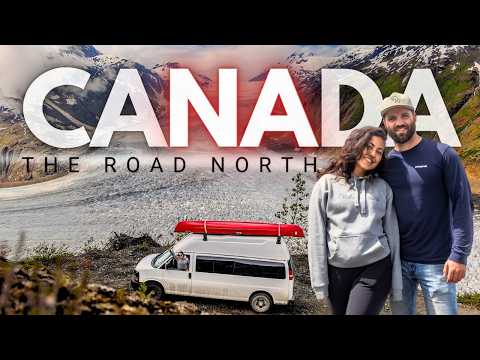
Places in this video
- Hope Slide ▶ 3:14
They camp at the Hope Slide on Highway 3 (Crowsnest Highway) and recount the 1965 earthquake-triggered landslide that buried the valley and killed travelers.
- Smithers ▶ 14:34
They return to the small mountain town of Smithers and hike a trail toward a waterfall, spotting marmots along the way.
- Stewart-Cassiar Highway ▶ 17:00
They call it one of the two gateways to the north and their favorite route, with amazing lakes, camping and hiking along the way to the Yukon.
- Salmon Glacier ▶ 21:20
They drive a bumpy 30 km road up to camp near the glacier, catching glimpses of its turquoise pools and the ice in the morning sun.
- Stewart ▶ 21:20
They stop in Stewart for a late lunch in the pouring rain before heading up toward the Salmon Glacier.
- Cassiar ▶ 27:53
They explore the abandoned asbestos mining town, walking the old airstrip, checking out relics and the overgrown grid of former streets.
- Yukon River ▶ 40:51
They begin a 15-day, 700 km canoe trip down the Yukon River from Whitehorse to Dawson City, traveling the old-fashioned way.
- Lake Laberge ▶ 42:08
They call it their first obstacle, a behemoth lake known for picking up winds, and end up windbound and paddling it in the early hours.
- Thirty Mile River ▶ 55:43
They paddle the 30-mile stretch from Lower Laberge to the Teslin River, a Canadian heritage site with old telegraph lines and cabins from the gold rush.
- Evelyn steamboat wreck ▶ 58:17
They try to reach the old steamship Evelyn near the Teslin River confluence but get pushed back by the current and miss it.
- Big Salmon Village ▶ 1:06:58
They stumble on the old village at the mouth of the Big Salmon River, with log cabins and structures from a once-thriving early 1900s settlement.
- Coal Mine Campground and Cantina ▶ 1:13:45
After seven days of paddling they celebrate 'Carmax day' with burgers and ice cream at this riverside campground and cantina.
- Tantalus Butte ▶ 1:14:21
They pass the big rock formation called Tantalus, named for being tantalizingly visible from far off but slow to reach by paddle.
- Five Finger Rapids ▶ 1:24:28
They take on the rapids, shipping water over the bow, and later find the second set of rapids to be nothing but a riffle.
- Tom's Cabin ▶ 1:29:29
They find one of the few remaining cabins in good standing along the river, with a tin roof, once home to a gold rusher who never returned home.
- Fort Selkirk ▶ 1:34:55
They explore the once-bustling trading village at the Pelly and Yukon confluence, learning about Robert Campbell's post and its burning by the Tlingit.
- White River ▶ 1:44:44
When the White River mixes with the Yukon it turns the water thick and milky, forcing them to boil and settle river water for drinking.
- Sixty Mile River ▶ 1:54:19
They pull up at the crystal-clear Sixty Mile River to take a bath near the end of the paddle.
- Moosehide Slide ▶ 1:54:36
They say the iconic Moosehide Slide will signal the end of their 700 km paddle as they approach Dawson City.
- Dawson City ▶ 1:55:01
They finish the river trip in Dawson City and spend their 15th day hanging out in the gold rush town, reading Robert Service's words on a wall.
- Cottonwood Creek ▶ 1:59:09
They stop at the creek to catch Arctic grayling before crossing the Arctic Divide south of Dease Lake.
- Dease Lake ▶ 2:02:56
They top up fuel, water and batteries in Dease Lake before starting the gravel detour to Telegraph Creek.
- Telegraph Creek Road ▶ 2:03:11
They take the 112 km gravel detour with steep grades up to 20%, calling the canyon the Grand Canyon of the Stikine.
- Telegraph Creek ▶ 2:13:37
They reach the sleepy riverside town on the Stikine, home to a few hundred people and steeped in gold rush and telegraph line history.
- Glenora ▶ 2:14:06
They drive upriver looking for the old gold rush town of Glenora, but find most of its buildings flattened and never quite locate it.
- Stikine River Song Cafe and Lodge ▶ 2:16:24
They stop at the cafe/bakery in the old Hudson's Bay Company building, get a tour of the rustic lodge, showers and slices of homemade pie.
- Bella Coola ▶ 2:27:40
They descend the steep hill from Heckman Pass into the coastal town, learning how locals bulldozed the road themselves in the 1950s.
- Heckman Pass ▶ 2:27:40
They start a long, steep descent from the top of Heckman Pass down to sea level, calling it one of the steepest roads in British Columbia.
- Stupendous Viewpoint ▶ 2:33:04
They stop at the viewpoint on the way into Bella Coola, where they watch a mother black bear and her playful cub.
- North Bentinck Arm ▶ 2:38:31
They camp by the water on North Bentinck Arm and climb on an old rusted barge that once brought supplies in by sea.
Cities in these videos
Hope · Smithers · Kitwanga · Stewart · Cassiar · Whitehorse · Carmacks · Pelly Crossing · Dawson City · Dease Lake · Telegraph Creek · Bella Coola