 PlaceTube
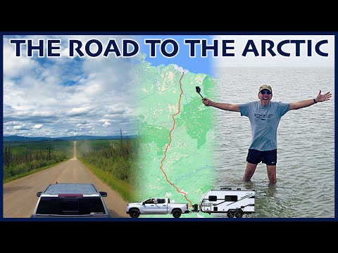
Driving the Treacherous Dalton Highway, the Northernmost Road in America
Open in PlaceTube Watch on YouTube
Places in this video
- Dalton Highway ▶ 0:11
The presenter introduces the Dalton Highway, one of North America's most remote and dangerous roads, which he will drive from Fairbanks to Deadhorse.
- Livengood Junction ▶ 1:47
He explains that the Dalton Highway officially begins 80 miles north of Fairbanks at Livengood Junction, where the pavement ends.
- Alyeska Pipeline Viewpoint ▶ 2:04
The first stop is a pullout where you can stand under the Trans-Alaska Pipeline and see interpretive signs and retired pipeline pigs.
- Arctic Circle Sign ▶ 4:14
He points out the Arctic Circle marker on the Dalton Highway, a key landmark of the journey.
- Elliott Highway ▶ 4:45
He describes driving about 70 miles of the paved Elliott Highway, which already has frost heaves and construction.
- Hess Creek Overlook ▶ 10:06
This would have been their first point of interest, but it is closed due to construction.
- Yukon River Camp ▶ 12:31
They stop at Yukon River Camp, which has a restaurant, hotel, convenience store and fuel; they have sandwiches for lunch and fill up at $7.49 a gallon.
- E.L. Patton Bridge ▶ 12:33
They cross the Yukon River on the wooden deck of the E.L. Patton Bridge, the only bridge crossing the Yukon in Alaska, which also carries the pipeline.
- Yukon Crossing Contact Station ▶ 13:29
He points out the small cabin of the Yukon Crossing Contact Station with interpretive signs, though it is closed.
- 86 Mile Overlook ▶ 18:56
They detour up a hill to the 86.5 mile overlook for views toward the Yukon Flats National Wildlife Refuge.
- Finger Mountain Wayside ▶ 21:52
They stop at Finger Mountain, where he explains the granite tors and hikes to the highest point for a view.
- Five Mile Campground ▶ 24:19
He mentions Five Mile Campground as the closest dump station, which they later reach on the return trip.
- Arctic Circle Campground ▶ 25:13
They spend the night at the BLM campground at the Arctic Circle, where the sun never sets.
- Gobbler's Knob ▶ 29:42
They drive 17 miles north to Gobbler's Knob, one of the best places to witness the midnight sun.
- Grayling Lake ▶ 37:00
He points out Grayling Lake, a beautiful lake he even wrote a song about, and later spots a moose there.
- Coldfoot ▶ 38:15
Coldfoot is the psychological halfway point and the only place to get fuel for the next 240 miles; he recounts its gold rush history and the unofficial -82°F record.
- Arctic Interagency Visitor Center ▶ 38:31
They stop at the visitor center run by the BLM, US Fish and Wildlife Service and National Park Service, with exhibits on northern animals and the midnight sun.
- Coldfoot Truck Stop ▶ 39:22
They fuel up at the northernmost truck stop, where only one pump works, at $7.49 a gallon.
- Coldfoot Camp ▶ 40:43
He shows the historic cabin, tent camping field and the hotel where they stayed in 2010, plus RV hookups.
- Marion Creek Campground ▶ 42:37
They stay at Marion Creek Campground, a BLM campground with a manual water pump and views of the Brooks Range.
- Wiseman ▶ 47:03
He mentions the detour to the Arctic village of Wiseman, which they skip this time though they stayed there in 2010.
- Sukakpak Mountain ▶ 47:35
They stop to admire the granite wall of Sukakpak Mountain, whose name means martin deadfall in Iñupiaq.
- Middle Fork Koyukuk River Rest Area ▶ 48:55
They stop at a small rest area in the shadow of Sukakpak Mountain with river access, possibly the spot they stopped in 2010.
- Atigun Pass ▶ 51:04
They climb to Atigun Pass, the continental divide at 4,739 feet, where it can snow any time of year.
- End of the Boreal Forest ▶ 52:36
He shows the sign marking the end of the boreal forest and the beginning of the tundra, near the site of the northernmost spruce tree.
- Chandalar Shelf ▶ 53:48
They stop at the Chandalar Shelf near the headwaters of the Chandalar River for the views of the towering peaks ahead.
- Galbraith Lake Campground ▶ 59:40
They check out the BLM campground at Galbraith Lake, which has amazing mountain views but relentless mosquitoes.
- Toolik Lake Research Station ▶ 1:01:40
He notes the University of Alaska Fairbanks research station at Toolik Lake, accessible by invitation only.
- Happy Valley ▶ 1:03:31
They stop at Happy Valley, a former pipeline construction camp now used by scientists, and boondock across the highway for the night.
- Sag River Overlook ▶ 1:04:37
He mentions the Sag River Overlook, which they missed on the way north but stop at on the return.
- Franklin Bluffs ▶ 1:05:42
He points out the Franklin Bluffs on the right as the road turns to smooth blacktop near the coast.
- Deadhorse Camp ▶ 1:06:25
Deadhorse Camp is where their Arctic tour departs from, and they return there to wait for the afternoon tour.
- Aurora Hotel ▶ 1:07:24
He calls the Aurora Hotel probably the best lodging option in Deadhorse.
- Deadhorse General Store ▶ 1:08:12
They visit the general store for the symbolic end-of-the-road photo and to look for fuses.
- Arctic Ocean ▶ 1:09:34
On the Arctic tour they reach the Arctic Ocean at a natural gravel beach, where he wades into the frigid water.
- Fairbanks KOA ▶ 1:25:45
They end the trip back at the Fairbanks KOA, where they get a pull-through site and clean up the RV.