 PlaceTube
我们到达中国陆地最东端,黑瞎子岛,与俄罗斯仅一河之隔🇨🇳🇷🇺
Open in PlaceTube Watch on YouTube
Places in this video
- Heixiazi Island ▶ 0:00
The easternmost land in China, a river delta where the Ussuri and Heilongjiang rivers meet, returned to China in 2008 and now a wetland park.
- Black Bear Park ▶ 1:04
A park on Heixiazi Island with over 100 black bears, explored from a steel-barred safari vehicle; the presenters saw nearly 20 bears even in winter.
- Wusu Bridge ▶ 5:00
The bridge the pair drive across to reach Heixiazi Island, crossing obliquely over the island toward the Heilongjiang riverside.
- G102 National Highway terminus ▶ 5:16
The end of the 2,000-km Jingfu Line that starts in Beijing and terminates here in Fuyuan, marked with a G102 sign.
- Dongji Pagoda ▶ 6:25
The tallest building on the Chinese side of Heixiazi Island, surrounded by 56 totem poles representing China's ethnic groups; its elevator was closed in winter.
- Sino-Russian boundary marker site ▶ 6:40
The spot where China and Russia unveiled the boundary marker on October 14, 2008, when Heixiazi Island officially returned to China.
- Taiji Square ▶ 15:39
A huge circular square 171 meters in diameter at the foot of Dongji Pagoda, decorated with reliefs, a tripod, and a bell and drum.
- Dongji Square ▶ 19:02
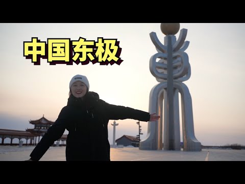
The spot where China's first ray of sunlight arrives each day, with a giant sculpture of crossed characters holding a sun, and a signpost of distances to world cities.
- Eastern boundary marker, Heixiazi Island National Wetland Park ▶ 21:22
An eastern boundary marker erected in 2012 at Dongji Square, following the 2004 Sino-Russian supplementary agreement on the eastern border.
- Dongji Square pavilion ▶ 21:38
A pavilion at the tip of Dongji Square shaped like a ship's bow, from whose second floor they view the Ussuri River, Russian towns, and the Tonghe river.