 PlaceTube
Hiking Cerro Picacho 🇵🇦 Panama’s Ultimate Mountain View (San Carlos Guide)
Open in PlaceTube Watch on YouTube
Places in this video
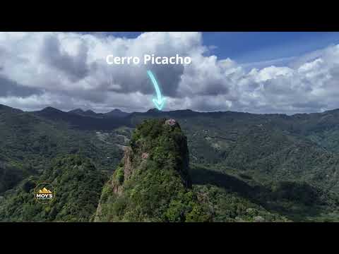
- Cerro Picacho ▶ 0:25
The video's main subject: a sharp, rocky green peak about 1,180 m above sea level in the Cordillera Central, reached by a short but steep trail with roots, rocks and ropes.
- Bridge of the Americas ▶ 0:40
Mentioned as the point where the drive west from Panama City crosses the Panama Canal on the Pan American Highway.
- Las Lajas ▶ 0:40
The presenter says to make a right here and follow the signs toward Laguna de San Carlos.
- Coronado ▶ 0:51
The town reached after about 1.5 hours and 100 km on the Pan American Highway, where you turn off toward Las Lajas and the lagoon.
- Laguna de San Carlos ▶ 0:56
You park near this lagoon at the foot of the mountain, and from the summit its calm waters can be seen resting among the hills.
- San Carlos District ▶ 1:51
The hike is in the district of San Carlos, province of Panama Oeste, part of the Cordillera Central, with rolling green ridges and distant views of the Pacific.