 PlaceTube
Mexico City Map - EXPLAINED
Open in PlaceTube Watch on YouTube
Places in this video
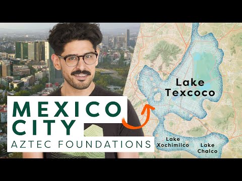
- Lake Texcoco ▶ 0:44
The presenter explains that Mexico City sits on the former lake bed of Lake Texcoco, a saline lake that provided edible flora and fauna to its inhabitants.
- Xochimilco ▶ 0:44
Mentioned as one of the freshwater lakes, and later described as the site of the last remaining canals and chinampas from the pre-Columbian era, where you can ride colorful trajineras boats.
- Teotihuacan ▶ 1:16
The presenter notes the region was occupied for thousands of years by civilizations such as the empire of Teotihuacan.
- Tenochtitlan ▶ 1:35
The Aztec capital founded in 1325 on an island in Lake Texcoco, built on chinampas and divided into four neighborhoods around the Templo Mayor.
- Coyoacan ▶ 3:09
Described as the famous bohemian neighborhood where Frida Kahlo lived, connected by a causeway to Iztapalapan.
- Chapultepec ▶ 3:09
Mentioned as the destination of an eastern causeway out of Tenochtitlan, later becoming San Miguel de Chapultepec.
- Templo Mayor ▶ 3:25
The temple at the center of Tenochtitlan that divided the island into four neighborhoods; its ruins now sit by the Zócalo.
- Castillo de Chapultepec ▶ 8:01
Maximilian I lived here after arriving in 1864 and gave the castle its neoclassical features; the presenter films from its edge.
- Avenida la Reforma ▶ 8:18
The long avenue stretching out behind the Castillo de Chapultepec, built by Maximilian to connect his home with the city's main square.
- Palacio de Bellas Artes ▶ 8:52
The infamous palace constructed during the Porfiriato, when French-influenced architecture bloomed in Mexico City.
- El Centro ▶ 9:24
The historic center of the city within the Cuauhtémoc borough, where most of the landmarks visitors want to see are located.
- Plaza de la Constitucion (El Zocalo) ▶ 9:24
The main square, better known as El Zócalo, which holds the National Palace, the Metropolitan Cathedral and the ruins of the Templo Mayor.
- National Palace ▶ 9:41
Listed as one of the buildings on El Zócalo, at the ancient heart of the city.
- Metropolitan Cathedral ▶ 9:41
Listed as one of the buildings on El Zócalo, at the ancient heart of the city.
- National Autonomous University of Mexico ▶ 9:57
The university in the Coyoacán borough, whose main campus Ciudad Universitaria was the largest single construction project in Mexico since the Aztecs.
- Estadio Olimpico Universitario ▶ 10:13
The 1968 Olympic Stadium, mentioned among the sports facilities on the Ciudad Universitaria campus.
- Villa de Guadalupe ▶ 10:44
The site north of El Centro that houses the Basilica of Our Lady of Guadalupe at the foot of Tepeyac Hill, where the Virgin Mary is believed to have appeared to Juan Diego.
- Tepeyac Hill ▶ 10:44
The hill at whose foot the Villa de Guadalupe and Basilica sit, where the Virgin Mary is said to have appeared to Juan Diego.
- Circuito Interior ▶ 11:15
The freeway loop surrounding the central neighborhoods, about 42 km long and made up of smaller highways and boulevard sections.
- El Periferico ▶ 11:31
The outer beltway whose southern section is known for its two-level highway systems completed in the early 2000s.
- Avenida Insurgentes ▶ 11:50
The longest road in Mexico City at about 29 km, with Metrobus platforms along its center spine, connecting southern and northern neighborhoods with the business district.