 PlaceTube
A Curly Wyrley Loop - A 35 Mile Traffic Free CYCLING Loop From Wolverhampton
Open in PlaceTube Watch on YouTube
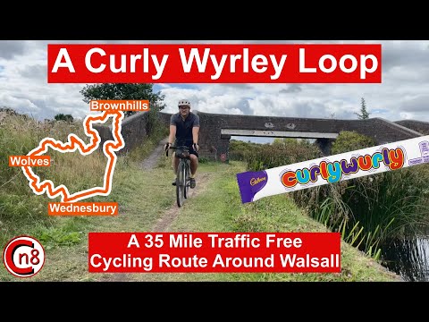
Places in this video
- Horseley Fields ▶ 0:00
The presenter starts and ends his ride at Horseley Fields, just outside Wolverhampton city centre, where the Birmingham Mainline Canal meets the Wyrley and Essington Canal.
- Wyrley and Essington Canal ▶ 0:36
Known locally as the Curly Wyrley, this canal forms the first 21 miles of the loop; the presenter follows its towpath and explains its history, twists and flat-topped bridges.
- Horseley Fields Stop Lock ▶ 1:08
The presenter stops at the narrow section where the original stop lock separated the Birmingham Canal from the Wyrley and Essington Canal, kept six inches higher to gain water.
- Heath Town Silver Arch ▶ 2:31
A dramatic archway built on the site of an old dismantled railway bridge, which the canal passes under on its way through the old industrial area.
- Bentley Bridge Retail Park ▶ 3:05
The towpath passes the retail park where the old Bentley Canal once branched off under the bridge, with only a short stub by the Nickelodeon pub remaining.
- Bentley Canal ▶ 3:15
Opened in 1843 to link the Wyrley and Essington Canal to the Anson branch of the Walsall Canal, it served steelworks and quarries before closing in the early 1960s.
- Short Heath ▶ 3:57
The canal winds between Willenhall and Short Heath through mostly residential areas, a pretty green corridor with lily pads on the water.
- Hollybank Basin ▶ 4:58
Also known as the Short Heath Branch Canal, this short arm off the canal was once used as a railway interchange, though it looks green and pleasant today.
- Bentley Hay Nature Reserve ▶ 5:03
The route enters this nature reserve where the towpath becomes narrower and more natural, passing Bentley Wharf Bridge, an area once heavily worked for clay and coal.
- Sneyd Junction ▶ 5:50
Once a very important canal junction where the main line headed north with branches to Essington and Wyrley; the branch closed in 1955 and now only runs to the drain.
- Ruffwood Country Park ▶ 5:51
After passing under the M6, the route goes through Ruffwood Country Park along a bumpy section of towpath towards Sneyd Junction.
- Bloxwich ▶ 7:12
The route winds through Bloxwich towards Walsall, passing a large construction project beside the canal that turns out to be an energy-from-waste plant.
- Birchills Junction ▶ 8:30
The junction where the Wyrley and Essington Canal meets the Walsall Canal, created in 1840 to link the two canals; the route turns north here.
- Chase Line ▶ 9:39
The canal passes over the Cannock to Walsall railway, better known as the Chase line, which runs through Cannock Chase to Rugeley Trent Valley.
- Little Bloxwich ▶ 9:51
The canal twists and turns north towards Little Bloxwich and Pelsall Common, passing under Tiss's Bridge which carries Stony Lane over the canal.
- Pelsall Common ▶ 10:26
A tranquil area of heathland that was once the site of Pelsall Iron Works with blast furnaces, pudding furnaces and mills, surrounded by coal mines.
- Pelsall Junction ▶ 14:03
One of the most important junctions on the canal, where the Wyrley and Essington meets the Cannock Extension Canal, built to carry coal from the Cannock coalfields.
- The Fingerpost ▶ 15:25
A pub right on the side of the canal at Pelsall Junction, which the presenter says would be a lovely place to enjoy this part of the network.
- Brownhills ▶ 15:39
The route winds towards Brownhills, passing under the Beacon Way and the McClean Way; the town was hit hard by the decline of coal mining and has worked to rejuvenate its economy.
- Clayhanger Common ▶ 16:28
A common on the right of the canal that was previously a council tip from the 1950s to the early 1980s, later capped with colliery spoil and landscaped.
- Brownhills Wharf ▶ 16:44
Two short arms once went off to a railway interchange here; one is used for mooring today and the other is a ramp for the local canoe club.
- Catshill Junction ▶ 17:20
Another important junction on the edge of Brownhills, where the main line headed to Lichfield and the Anglesey branch went up to Chasewater; the route takes the Daw End branch.
- Daw End Branch Canal ▶ 18:22
Completed in 1800, this five-mile branch was built to carry coal and connect to the limestone quarries at Hay Head; the route follows it past Walsall Wood and Aldridge.
- Walsall Wood ▶ 19:05
The canal winds past Walsall Wood and Aldridge, areas of coal and clay mining that fuelled brick and tile making; the route passes Latham's Bridge with its industrial mural.
- Aldridge ▶ 20:00
As the route enters Aldridge the canal sits on a large embankment built up to counter mining subsidence, and the towpath narrows to a dirt track.
- Longwood Junction ▶ 22:52
The Daw End branch ends here where it meets the Rushall Canal, with the short Hay Head branch spur to the left now used for mooring narrowboats.
- Rushall Canal ▶ 24:28
Built in 1847, this almost perfectly straight canal has nine locks and takes the route downhill past the edge of Walsall to Rushall Junction.
- Rushall Junction ▶ 26:19
After passing under the M6, the route reaches Rushall Junction where the Tame Valley Canal meets the Rushall Canal, and turns right towards Wednesbury.
- Tame Valley Canal ▶ 26:34
Opened in 1844 to bypass Birmingham city centre, this very straight canal uses large embankments and cuttings, and its aqueduct crosses the M5.
- Tame Valley Junction ▶ 29:15
The junction where the Tame Valley Canal meets the Walsall Canal; the route crosses the classic black and white bridge and heads north up the Walsall Canal.
- Walsall Canal ▶ 29:48
The route spends a mile on this canal with a solid towpath, heading north from Broadwaters towards Darlaston on a canal built in several sections from 1783.
- Bradley Branch Canal ▶ 30:36
The route follows this disused branch line, now a wooded path with old lock flights still holding water, up to the Wednesbury Oak Loop.
- Wednesbury Oak Loop ▶ 31:58
Part of the old Birmingham Mainline Canal built by James Brindley, this loop was bypassed by Telford's New Mainline but kept in water by a pumping station.
- Coupé Basin ▶ 34:20
The route comes out at this basin where it meets the Birmingham New Mainline Canal just north of the Coseley Tunnel, then turns north back towards Wolverhampton.
- Birmingham New Mainline Canal ▶ 34:42
The final three miles of flat riding back to Horseley Fields follow this Telford-engineered canal, part of National Cycle Network Route 81.