 PlaceTube
Unseen Lake Powell: The Vanishing Reservoir That Reveals a Hidden World
Open in PlaceTube Watch on YouTube
Places in this video
- Lake Powell ▶ 0:47
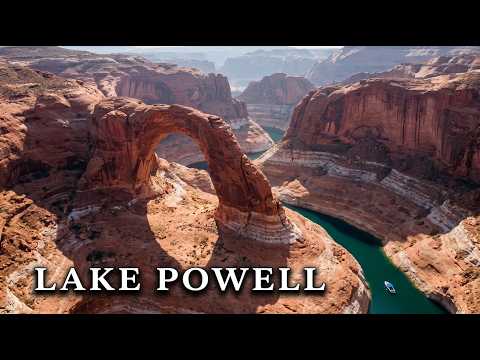
The video introduces Lake Powell as a brilliant blue reservoir winding between colossal red rocks across Arizona and Utah, whose falling waters are revealing long-hidden places.
- Glen Canyon Dam ▶ 2:43
The dam is described as 710 ft tall, built to store water and sell power, authorized in 1956 and finished in 1963; the video notes its spillway damage in 1983 and its role in flooding Glen Canyon.
- Page ▶ 8:20
The presenter explains that Page was built from nothing by the Bureau of Reclamation in 1957 to house dam workers, on land that was Navajo until 1958, and residents could not elect a mayor until 1975.
- Lone Rock ▶ 10:59
Lone Rock is described as the top of a sandstone butte standing in open water, with a growing sand beach where campers now park on former lake bottom and a cave reachable on foot at low water.
- Wahweap Bay ▶ 12:43
Wahweap Bay, whose name comes from a Southern Paiute phrase usually translated as bitter water, is the wide sheltered bay where most boat traffic on the lake starts.
- Wahweap Marina ▶ 13:17
A marina with a resort and campground grew on the sheltered bay, setting turquoise water against bare red rock with no green on any shore.
- Antelope Canyon ▶ 13:59
The presenter describes Antelope Canyon's Navajo name meaning the place where water runs through rocks, the 1997 flash flood that killed 11 visitors, and the rule that visitors must go with a Navajo guide.
- Defiance House ▶ 17:45
A University of Utah crew found this Ancestral Puebloan village in Forgotten Canyon in 1959, named for three shield-bearing figures painted beside it, with roofs and bowls of food still intact.
- Horseshoe Bend ▶ 18:43
The river wraps 270 degrees around a neck of rock here, and visitors watch from a bare sandstone rim with more than 500 ft of open air beneath them.
- Navajo Bridge ▶ 20:54
The steel arch carries a highway across the Colorado where the reservoir becomes a river again; it opened in June 1966, built to span a reservoir rather than a river, and now spans a river again.
- Gregory Natural Bridge ▶ 24:11
The stone span broke the surface again in 2022 after 60 years under the reservoir as the drought deepened.
- Reflection Canyon ▶ 25:43
With no road or trail sign, Reflection Canyon became famous through a magazine photograph; its iconic S shape is best read from the air, and most visitors arrive by boat or walk in across slick rock.
- Lees Ferry ▶ 27:44
John D. Lee hid here after the 1857 massacre, his family farmed Lonely Dell and planted orchards, and 150 years on the stone fort still stands and the park service lets anyone who walks in eat the fruit.
- Gregory Butte ▶ 28:52
The sandstone tower over the water is named after geologist Herbert Gregory, sent in 1909 to find water for the Navajo Nation and who stayed to map the plateau.
- Hole-in-the-Rock ▶ 29:44
The narrow crack was blasted wider and a road built on oak stakes so that 83 wagons, 250 people and a thousand animals descended in the winter of 1880, with nobody dying and two babies born.
- Cathedral in the Desert ▶ 31:27
The video notes that slot canyons like Cathedral can now be entered only by kayak because no power boat will fit between the walls.
- Gunsight Butte ▶ 32:01
The butte's two high points with a gap between them look like a rifle's rear sight, and geologists took 475 ft of its face as the standard defining a rock layer across the region.