 PlaceTube
New Zealand’s South Island: The Scotland of Southern Hemisphere
Open in PlaceTube Watch on YouTube
Places in this video
- Punakaiki Pancake Rocks ▶ 2:32
The presenter describes the layered limestone cliffs where the Tasman Sea erupts through blowholes, throwing spray 60 feet into the air, and notes the unexplained 'styler bedding' pattern.
- Paparoa National Park ▶ 2:51
The Pancake Rocks are said to sit where limestone cliffs meet dense coastal rainforest inside Paparoa National Park.
- Waiuta Ghost Town ▶ 4:30
At a dead end in the West Coast bush, the presenter shows an abandoned town with its swimming pool and rugby posts still standing, empty since 1951.
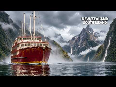
- Milford Sound ▶ 6:27
The presenter explains that Milford Sound is actually a glacier-carved fjord, with sheer walls, heavy rain, and a dark tannin-stained freshwater layer above the sea.
- Milford Sound Underwater Observatory ▶ 8:28
Along the fjord's northern wall, visitors descend beneath the dark freshwater layer to watch black coral, snake stars, and deep-water species at arm's length.
- Mount Aspiring National Park ▶ 11:46
The presenter describes the park's peaks, over 100 glaciers, and the rare Otago skink clinging to schist outcrops on its drier eastern edge.
- Glenorchy ▶ 14:00
The presenter explains that Glenorchy sits at the head of a long alpine lake, was long reachable only by steamship, and later built its own road to Queenstown.
- Paradise ▶ 14:57
Above Glenorchy, the beech forests fill Paradise valley, whose scenery attracted the Lord of the Rings, Narnia, Wolverine, and Mission: Impossible.
- Lake Wakatipu ▶ 15:16
The presenter describes the S-shaped glacial lake, its great depth, and the 27-minute seiche that makes the water rise and fall about 8 inches.
- Skippers ▶ 17:13
The presenter visits the ghost town on the Shotover River, once thick with gold and home to over 700 people, now described as a virtual ghost town.
- Nugget Point ▶ 18:01
The presenter shows the rocky islets worn into gold-nugget shapes offshore, with the Nugget Point Lighthouse standing about 76 m above the sea.
- Nugget Point Lighthouse ▶ 18:45
The lighthouse has guided ships since 1870 and remains one of the Catlins' best-known landmarks, standing high above the dangerous coast.
- Aoraki / Mount Cook ▶ 19:24
The presenter describes New Zealand's highest peak, sacred to Ngai Tahu, where climbers traditionally stop short of the summit, and recounts the 1894 first ascent and the 1991 rockfall.
- Mount Cook Village ▶ 22:38
The village provides a base for exploring the national park, having grown around mountaineering and tourism from the first Hermitage at White Horse Hill.
- St Bathans ▶ 24:27
Founded in 1863 for nearby gold mines, the town still has a strip of 19th-century buildings along its single street, beside the blue lake left by the washed-away Kildare Hill.
- Blue Lake ▶ 25:01
The pit left after Kildare Hill was blasted apart for gold filled naturally with rain and runoff, creating a vivid blue lake below the town.
- Golden Point Historic Reserve ▶ 25:34
At this abandoned mining site, the presenter shows the 1902 stamper battery, the only complete battery of its kind still on its original site and still capable of running.
- Purakaunui Bay ▶ 27:13
The presenter describes the coastal forest used by Maori for centuries, later crossed by a timber railway, now filled with forest, cliffs, beaches, and wildlife.
- Franz Josef Glacier ▶ 29:31
The presenter explains the glacier's Maori name and legend, its descent through rainforest, and its unusual advance between 1983 and 2008.
- Te Anau ▶ 31:19
The presenter explains how Te Anau grew from an isolated settlement into the gateway to Fiordland after the Homer Tunnel and Milford road opened.
- Lake Te Anau ▶ 32:42
The largest lake in the South Island has three long fjords on its western shore; its Maori name means cave of swirling water, and a caver found glowworms there in 1948.
- Bendigo ▶ 36:26
The presenter describes the goldfield where quartz reefs became some of the richest in Otago, leaving dozens of empty stone cottages and one of the country's most complete abandoned goldfields.
- Reefton ▶ 37:20
Nicknamed Quartzopolis, Reefton made history with New Zealand's first public electricity supply and electric street lighting, and historic buildings still line Broadway.
- Akaroa ▶ 38:57
The presenter describes the volcanic harbor, its French settler history, French street names, and the biennial festival celebrating the first arrivals.
- Akaroa French Festival ▶ 42:17
Every second year the town holds a festival with a parade celebrating families who trace their roots back to a single French ship.
- Abel Tasman National Park ▶ 42:54
The presenter describes golden beaches and forested headlands along a coast named for Abel Tasman, whose 1642 encounter turned violent and who never landed.
- Wanaka ▶ 44:47
The presenter explains that the town began during the Cardrona Valley gold rush and was known as Pembroke until adopting the name Wanaka in 1940.
- Lake Wanaka ▶ 45:48
The glacial lake fills a valley carved by successive ice advances, with clear water and several islands, and was used by Ngai Tahu for travel and food gathering.
- That Wanaka Tree ▶ 46:26
The presenter tells how a willow branch used as a fence post around 1939 took root in the lake and became one of the most photographed trees on Earth.
- Serpentine Church ▶ 47:55
Gold drew miners to the Rough Ridge range, and the settlement built the stone Serpentine Church, which later survived as a miner's cottage after the town faded.
- Lake Tekapo ▶ 48:22
The presenter explains the lake's bright turquoise hue, caused by fine glacial rock powder suspended in the meltwater scattering sunlight.
- Mackenzie Basin ▶ 48:56
The dry basin remained sparsely settled with sheep stations, and its dark skies made it an international dark sky reserve, one of the world's best places to see the night sky.
- Lindis Pass ▶ 50:06
The presenter describes the historic pass where Otago's first gold rush drew hundreds, leaving ruins including a store that became a stone hotel.
- Oamaru ▶ 50:40
The presenter shows the prosperous historic town with grand limestone buildings, one of the South Island's most complete 19th-century town centers.
- Oamaru fur seal colony ▶ 52:05
Along the rocky coast just outside town, New Zealand fur seals haul out in numbers close to a working port, having gradually returned after being hunted almost to extinction.
- Fox Glacier ▶ 53:26
The presenter describes the glacier flowing from the Southern Alps through steep valley walls and temperate rainforest, one of the few reaching so far toward the coast.
- Kaikoura ▶ 54:33
The presenter describes the coast long used by Maori, later shaped by whaling and coastal trade, with Fyffe House built on piles of whale vertebrae.
- Fyffe House ▶ 54:51
Built on piles made from whale vertebrae, Fyffe House survives as one of the few structures from the whaling era.
- Kaikoura Canyon ▶ 55:25
The canyon meets the continental shelf just offshore, drawing nutrient-rich water that supports dense fish communities and one of New Zealand's largest dusky dolphin populations.
- Lake Pukaki ▶ 57:09
The presenter describes the neon blue glacial lake that mirrors Mount Cook, doubled as Lake-town in The Hobbit, and serves as a hydroelectric reservoir.
- Queenstown ▶ 58:50
The presenter explains how Queenstown grew from a pastoral settlement around William Rees's homestead into a gold rush town, faded, then revived as one of New Zealand's biggest tourism centers.
Cities in these videos
Punakaiki · Waiuta · Milford Sound · Mount Aspiring National Park · Glenorchy · Queenstown · Kaka Point · Mount Cook Village · St Bathans · Purakaunui · Franz Josef / Waiau · Te Anau · Bendigo · Reefton · Akaroa · Takaka · Wanaka · Lake Tekapo · Omarama · Oamaru · Fox Glacier · Kaikoura · Lake Pukaki