 PlaceTube
Hike to TROLLTUNGA in NORWAY | All you need to know & the complete route
Open in PlaceTube Watch on YouTube
Places in this video
- Trolltunga ▶ 0:20
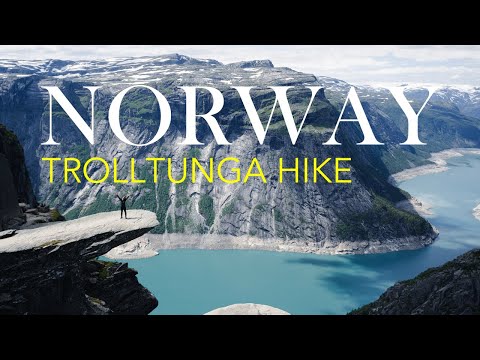
A spectacular rock formation jutting out horizontally about 10 m from a steep mountainside, around 700 m above Ringedalsvatnet Lake, offering a breathtaking view. There are no railings or barriers, and hikers queue for photos in high season.
- Skjeggedal ▶ 1:16
The hike starts here near the town of Odda; the presenter takes the first shuttle bus from the campsite to Skjeggedal in the morning.
- Trolltunga Campsite ▶ 1:26
The presenter stayed overnight here in a camper van to take the first bus to Skjeggedal; it is small and usually overcrowded, so arrive in the first half of the day.
- Odda ▶ 1:43
A popular tourist destination and starting point for many outdoor activities in the region, with many hotels and other accommodation options.
- P2 Skjeggedal Car Park ▶ 2:14
The official trail starts at the P2 car park in Skjeggedal; the full route is 27 km roundtrip with about 1,200 m of ascent.
- P3 Magelitopp Car Park ▶ 2:34
Taking the shuttle from P2 Skjeggedal to P3 Magelitopp shortens the route to 20 km roundtrip with about 800 m of ascent, taking 7 to 10 hours.
- Gryteskaret Pass ▶ 5:05
After about 45 minutes the route climbs steeply up a long rocky slope toward Gryteskaret Pass, considered one of the most demanding sections of the hike.
- Hardangervidda ▶ 5:46
From the high mountain plateau the landscape is vast and barren with patches of snow even in summer and views stretching far across the Hardangervidda Mountain region.
- Ringedalsvatnet ▶ 6:57
From time to time the fantastic view of Ringedalsvatnet Lake opens up as you walk through high plateaus with lakes, rivers and snow fields.
- Tyskabrygga ▶ 7:38
About 5 km before Trolltunga, this area is particularly popular for camping, with flat areas, small lakes and protection from the wind ideal for an overnight stay.